US county map
The United States is divided into 3,144 counties and county-equivalents covering 3,533,632 square miles of land. Select a state to open its own interactive county map, its full county table, and printable map files.
- Population
- Land area
- Divided into
Sources: US Census Bureau, Cartographic Boundary Files (1:500,000), 2025 Cartographic Boundary Files, released 23 April 2026; US Census Bureau, Population Estimates Program, Vintage 2025 Population Estimates, released 26 March 2026; US Census Bureau, Gazetteer Files, 2025 Gazetteer Files, released 10 September 2025. Retrieved 30 August 2026.
Satellite view
Aerial imagery of the contiguous United States with every state boundary drawn on top. Alaska and Hawaii are not in this frame: a single Web Mercator rectangle holding both Alaska and Florida spans half the planet and would leave the lower 48 too small to read. Their own state pages carry their own imagery.
Download the national map
All 3,144 counties in one frame, with state outlines and codes. The map on this page shows states because 3,144 shapes in one HTML response is a weight problem; the download has no such constraint and carries every county. Free to use and redistribute; the boundaries are public-domain Census Bureau data.
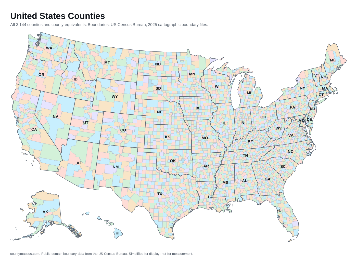
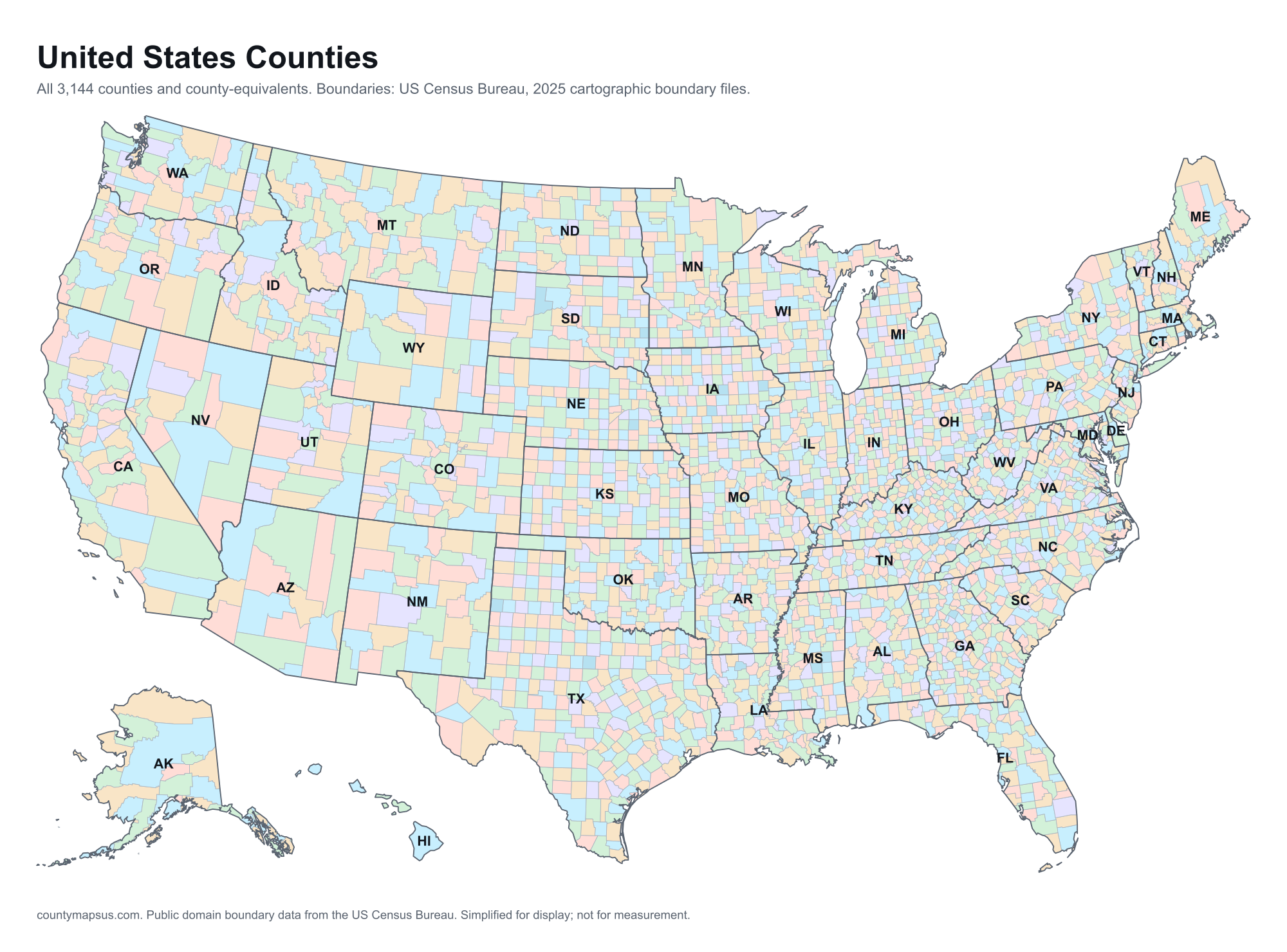
Per-state maps in five formats are on each state page, and every county page carries its own county map download.
Every state
- Alabama67 counties
- Alaska30 boroughs and census areas
- Arizona15 counties
- Arkansas75 counties
- California58 counties
- Colorado64 counties
- Connecticut9 planning regions
- Delaware3 counties
- District of Columbia1 county-equivalent
- Florida67 counties
- Georgia159 counties
- Hawaii5 counties
- Idaho44 counties
- Illinois102 counties
- Indiana92 counties
- Iowa99 counties
- Kansas105 counties
- Kentucky120 counties
- Louisiana64 parishes
- Maine16 counties
- Maryland24 counties
- Massachusetts14 counties
- Michigan83 counties
- Minnesota87 counties
- Mississippi82 counties
- Missouri115 counties
- Montana56 counties
- Nebraska93 counties
- Nevada17 counties
- New Hampshire10 counties
- New Jersey21 counties
- New Mexico33 counties
- New York62 counties
- North Carolina100 counties
- North Dakota53 counties
- Ohio88 counties
- Oklahoma77 counties
- Oregon36 counties
- Pennsylvania67 counties
- Rhode Island5 counties
- South Carolina46 counties
- South Dakota66 counties
- Tennessee95 counties
- Texas254 counties
- Utah29 counties
- Vermont14 counties
- Virginia133 counties and independent cities
- Washington39 counties
- West Virginia55 counties
- Wisconsin72 counties
- Wyoming23 counties
Most and fewest
Fewest counties
Texas has more counties than any other state by a margin of 95. Why that happened, and why the national total is not a settled number.
Three things a national county map does not show
- Not every entity is a county. Louisiana has parishes, Alaska has boroughs and census areas, Connecticut has planning regions, and 40 independent cities belong to no county at all. Nine legal types in total.
- 35 of them have no county government. Connecticut and Rhode Island abolished theirs, Massachusetts abolished most of its, and Alaska's census areas never had one. The full list.
- The boundaries move. Connecticut's changed in 2022, three Alaska entities changed shape in 2013 while keeping their identifiers, and counties are occasionally renamed, which usually forces a new FIPS code. Why codes change.
Boundaries and figures rebuilt 30 August 2026. How these maps are made.