Florida County Map
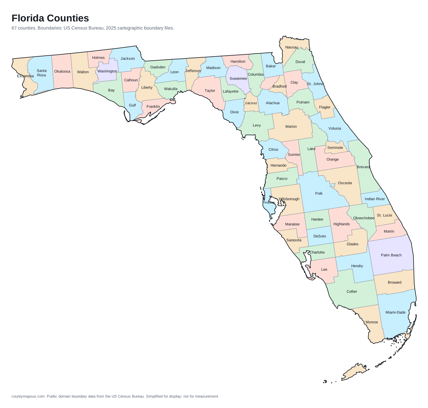
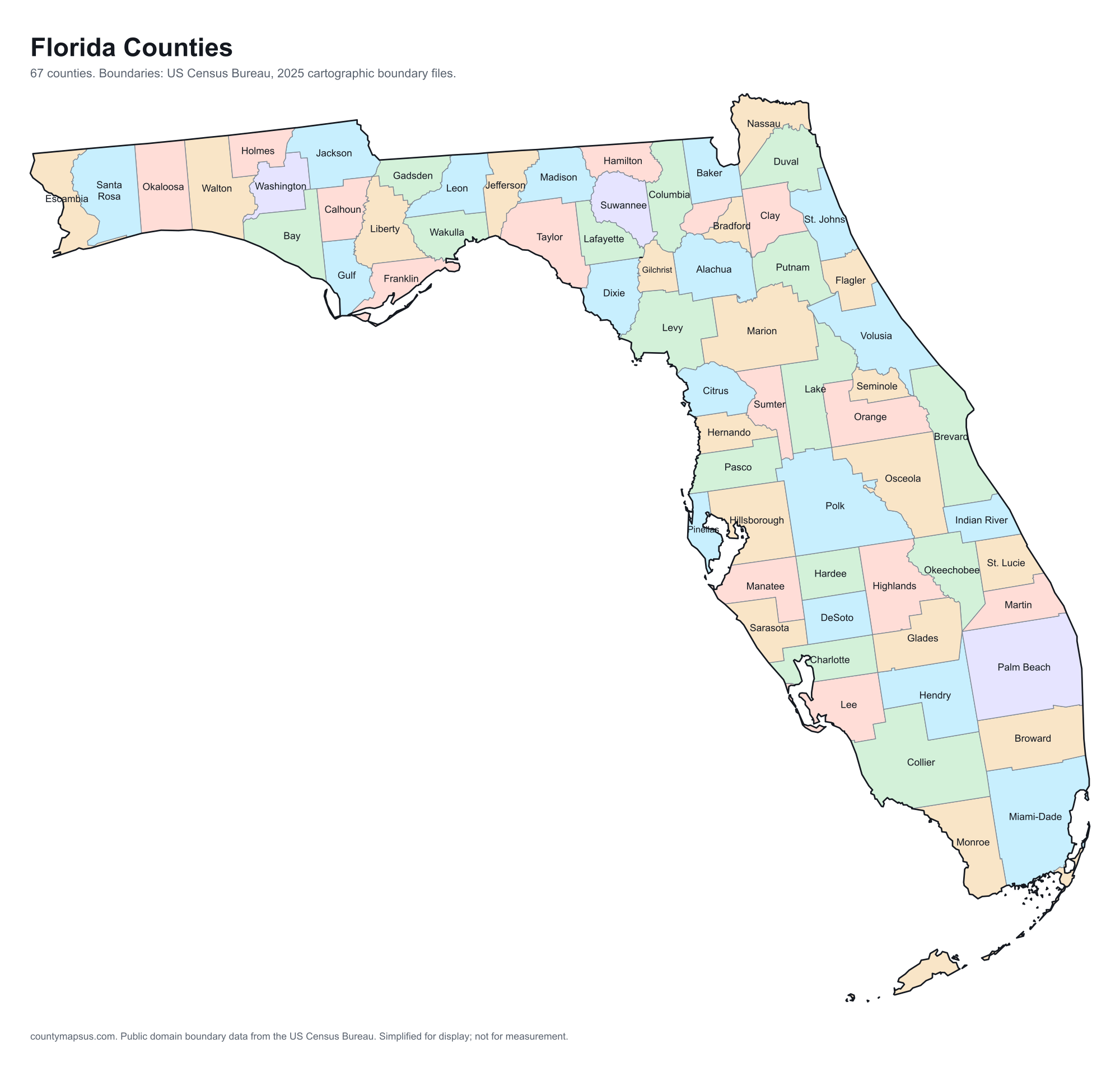
Florida has 67 counties. Together they cover 53,658 sq mi of land and 23,462,518 people.
- Population
- Land area
- Density
Neighbouring areas are given different colours so their shared borders read clearly. These colours carry no data.
Population from the Vintage 2025 estimates. Breaks are quintiles within Florida.
People per square mile, computed from population and land area. Breaks are quintiles within Florida.
Median household income, American Community Survey 2020 to 2024 five-year estimates. Breaks are quintiles within Florida.
- Counties
- 67
- 21st most of the 51 states and DC
- Population
- 23,462,518
- 3rd largest
- Land area
- 53,658
- square miles
- Density
- 437.3
- people per square mile, computed
Sources: US Census Bureau, Population Estimates Program, Vintage 2025 Population Estimates, released 26 March 2026; US Census Bureau, Gazetteer Files, 2025 Gazetteer Files, released 10 September 2025. Retrieved 30 August 2026.
Download this map
Free to use and redistribute. The boundaries are public-domain Census Bureau data; attribution to County Maps US is appreciated but not required.
Satellite view
Aerial imagery of Florida with the state boundary drawn on top. County lines are not drawn here: at this scale they would bury the picture, and the map above already carries them.
The extremes of Florida
Which is the largest county in Florida? The answer depends on whether you mean area or population.
The counties, by shape
Every one, drawn to its own scale so the small ones stay recognisable. Shape alone is not a size comparison; the table below carries the areas.
- Alachua
- Baker
- Bay
- Bradford
- Brevard
- Broward
- Calhoun
- Charlotte
- Citrus
- Clay
- Collier
- Columbia
- DeSoto
- Dixie
- Duval
- Escambia
- Flagler
- Franklin
- Gadsden
- Gilchrist
- Glades
- Gulf
- Hamilton
- Hardee
- Hendry
- Hernando
- Highlands
- Hillsborough
- Holmes
- Indian River
- Jackson
- Jefferson
- Lafayette
- Lake
- Lee
- Leon
- Levy
- Liberty
- Madison
- Manatee
- Marion
- Martin
- Miami-Dade
- Monroe
- Nassau
- Okaloosa
- Okeechobee
- Orange
- Osceola
- Palm Beach
- Pasco
- Pinellas
- Polk
- Putnam
- Santa Rosa
- Sarasota
- Seminole
- St. Johns
- St. Lucie
- Sumter
- Suwannee
- Taylor
- Union
- Volusia
- Wakulla
- Walton
- Washington
What the map does not say
The counties of Florida are nowhere near the same size. Collier County covers 1,997 sq mi of land, 8.2 times the 243.9 sq mi of Union County. People are spread even less evenly: Pinellas County packs 3,465 per sq mi while Liberty County holds 9.6 per sq mi.
They were not drawn in one sitting either. St. Johns County dates to 1821, and the boundaries were still being redrawn when Martin County was organised in 1925, 104 years later. Founding years come from Wikidata and are worth checking against the county's own history before citing.
Water is part of the picture too: 81.4% of Monroe County is water, the most in the state, which is why its land area and total area disagree. And 36 of the 67 counties here share their names with counties in other states, so searching by name alone can land in the wrong place; the A to Z index lists every duplicate.
All 67 counties of Florida
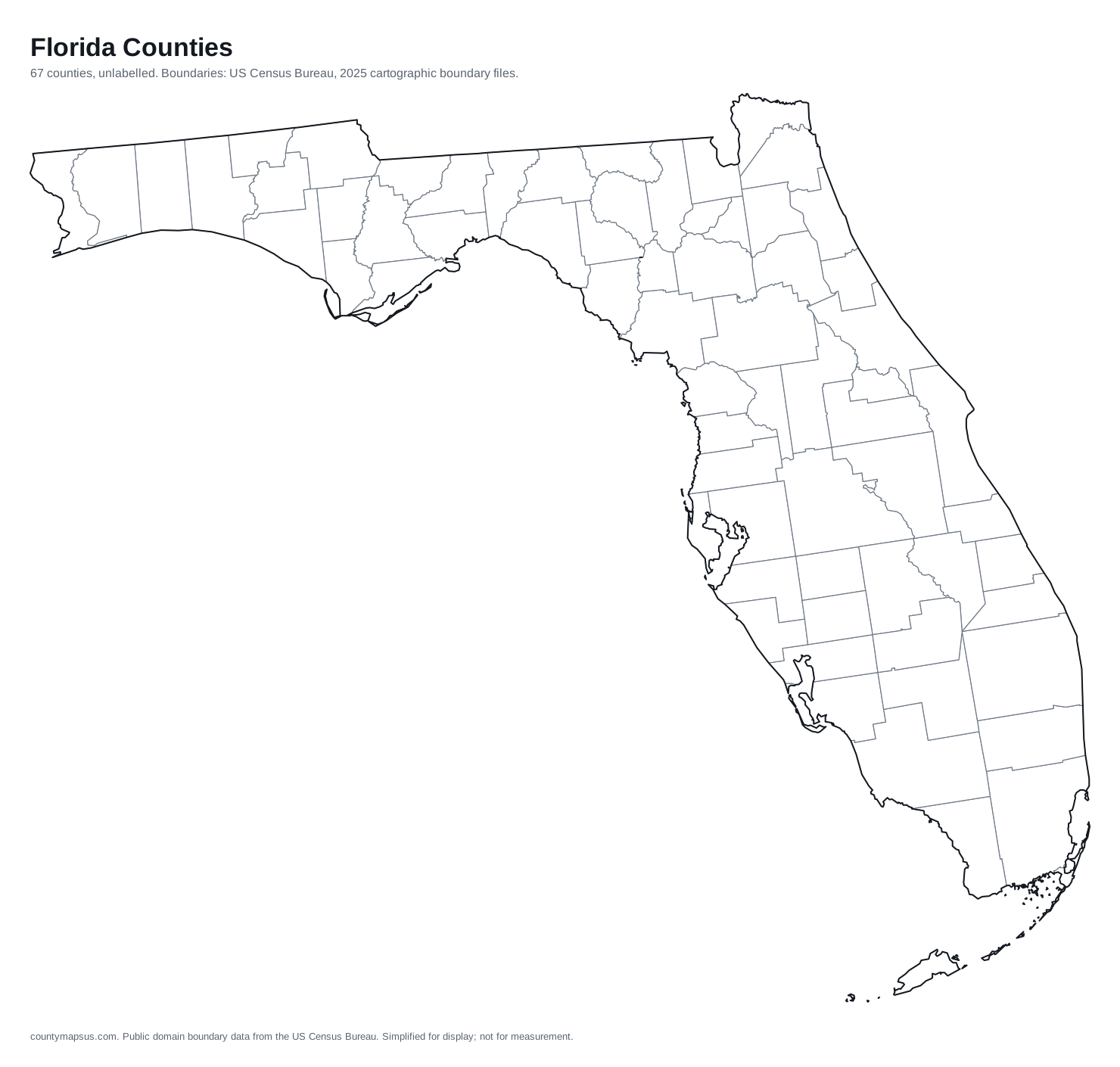
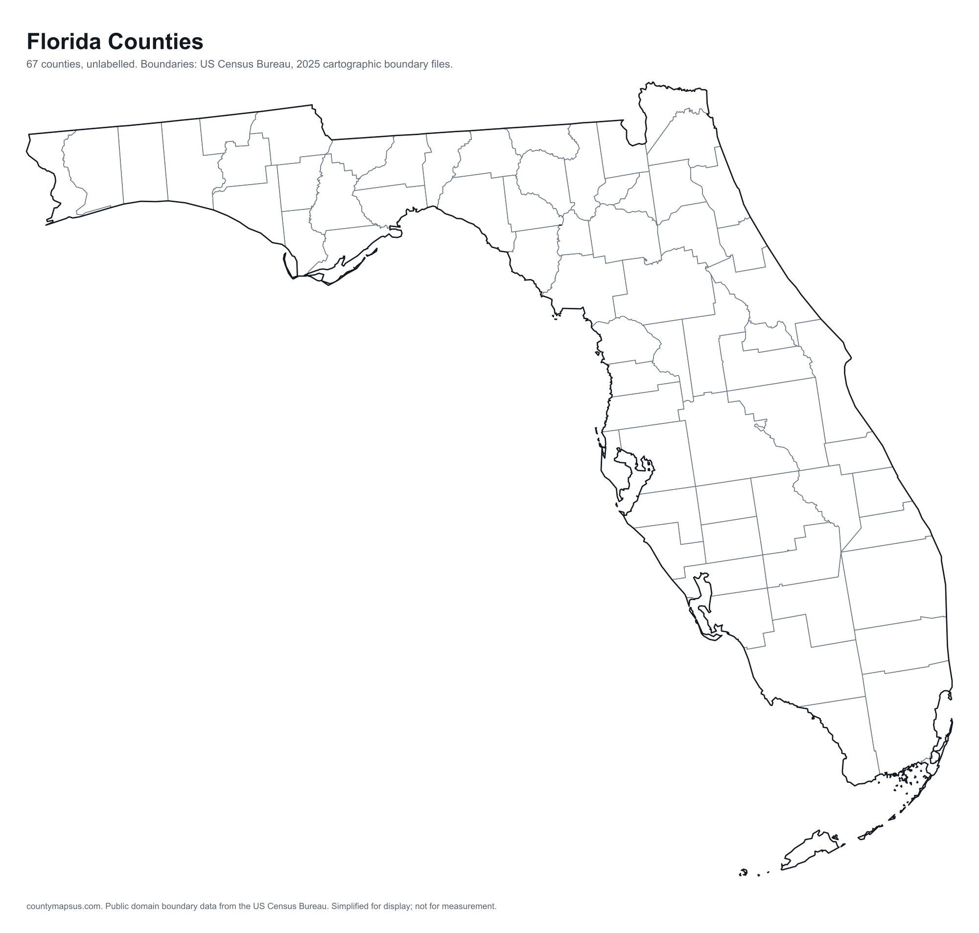
Sortable on any column. This table doubles as the text alternative to the map above: every area is a link, in alphabetical order, whether or not the map renders.
| Name | Population | Land area | Density | Median income | Seat | FIPS |
|---|---|---|---|---|---|---|
| Alachua County | 290,028 | 875.7 sq mi | 331 per sq mi | $61,949 | Gainesville | 12001 |
| Baker County | 29,737 | 585.2 sq mi | 50.8 per sq mi | $79,836 | Macclenny | 12003 |
| Bay County | 204,479 | 758.6 sq mi | 270 per sq mi | $73,533 | Panama City | 12005 |
| Bradford County | 28,307 | 294 sq mi | 96.3 per sq mi | $63,050 | Starke | 12007 |
| Brevard County | 663,982 | 1,015 sq mi | 654 per sq mi | $78,476 | Titusville | 12009 |
| Broward County | 2,013,317 | 1,203 sq mi | 1,674 per sq mi | $77,633 | Fort Lauderdale | 12011 |
| Calhoun County | 13,289 | 567.3 sq mi | 23.4 per sq mi | $50,517 | Blountstown | 12013 |
| Charlotte County | 217,212 | 681.1 sq mi | 319 per sq mi | $69,952 | Punta Gorda | 12015 |
| Citrus County | 171,666 | 582 sq mi | 295 per sq mi | $56,546 | Inverness | 12017 |
| Clay County | 239,593 | 604.6 sq mi | 396 per sq mi | $87,820 | Green Cove Springs | 12019 |
| Collier County | 417,131 | 1,997 sq mi | 209 per sq mi | $90,045 | East Naples | 12021 |
| Columbia County | 74,094 | 797.4 sq mi | 92.9 per sq mi | $59,205 | Lake City | 12023 |
| DeSoto County | 37,078 | 636.7 sq mi | 58.2 per sq mi | $54,417 | Arcadia | 12027 |
| Dixie County | 18,038 | 705 sq mi | 25.6 per sq mi | $50,110 | Cross City | 12029 |
| Duval County | 1,062,963 | 762.7 sq mi | 1,394 per sq mi | $71,277 | Q16568 | 12031 |
| Escambia County | 333,834 | 657 sq mi | 508 per sq mi | $67,500 | Pensacola | 12033 |
| Flagler County | 140,360 | 486.2 sq mi | 289 per sq mi | $77,363 | Bunnell | 12035 |
| Franklin County | 13,029 | 545 sq mi | 23.9 per sq mi | $64,105 | Apalachicola | 12037 |
| Gadsden County | 44,298 | 516.4 sq mi | 85.8 per sq mi | $48,801 | Quincy | 12039 |
| Gilchrist County | 20,488 | 349.7 sq mi | 58.6 per sq mi | $63,523 | Trenton | 12041 |
| Glades County | 13,270 | 806.8 sq mi | 16.4 per sq mi | $45,870 | Moore Haven | 12043 |
| Gulf County | 15,943 | 553.5 sq mi | 28.8 per sq mi | $61,179 | Port St. Joe | 12045 |
| Hamilton County | 14,180 | 514.3 sq mi | 27.6 per sq mi | $50,144 | Jasper | 12047 |
| Hardee County | 25,932 | 637.6 sq mi | 40.7 per sq mi | $60,489 | Wauchula | 12049 |
| Hendry County | 48,276 | 1,156 sq mi | 41.8 per sq mi | $56,393 | LaBelle | 12051 |
| Hernando County | 221,701 | 473 sq mi | 469 per sq mi | $66,058 | Brooksville | 12053 |
| Highlands County | 111,122 | 1,018 sq mi | 109 per sq mi | $54,897 | Sebring | 12055 |
| Hillsborough County | 1,574,115 | 1,023 sq mi | 1,539 per sq mi | $79,540 | Q49255 | 12057 |
| Holmes County | 20,119 | 478.9 sq mi | 42.0 per sq mi | $49,343 | Bonifay | 12059 |
| Indian River County | 172,799 | 502.6 sq mi | 344 per sq mi | $73,491 | Vero Beach | 12061 |
| Jackson County | 49,629 | 918.3 sq mi | 54.0 per sq mi | $49,149 | Marianna | 12063 |
| Jefferson County | 16,007 | 598.1 sq mi | 26.8 per sq mi | $61,212 | Monticello | 12065 |
| Lafayette County | 8,792 | 543.3 sq mi | 16.2 per sq mi | $62,757 | Mayo | 12067 |
| Lake County | 456,068 | 954 sq mi | 478 per sq mi | $73,161 | Tavares | 12069 |
| Lee County | 875,607 | 781.2 sq mi | 1,121 per sq mi | $76,107 | Fort Myers | 12071 |
| Leon County | 299,048 | 668.4 sq mi | 447 per sq mi | $66,287 | Tallahassee | 12073 |
| Levy County | 48,520 | 1,118 sq mi | 43.4 per sq mi | $56,750 | Bronson | 12075 |
| Liberty County | 8,035 | 835.6 sq mi | 9.6 per sq mi | $58,671 | Bristol | 12077 |
| Madison County | 18,759 | 696.5 sq mi | 26.9 per sq mi | $48,485 | Madison | 12079 |
| Manatee County | 468,200 | 742.8 sq mi | 630 per sq mi | $78,457 | Bradenton | 12081 |
| Marion County | 442,660 | 1,588 sq mi | 279 per sq mi | $61,010 | Ocala | 12083 |
| Martin County | 166,272 | 543.9 sq mi | 306 per sq mi | $82,943 | Stuart | 12085 |
| Miami-Dade County | 2,802,029 | 1,900 sq mi | 1,475 per sq mi | $71,753 | Miami | 12086 |
| Monroe County | 80,406 | 983 sq mi | 81.8 per sq mi | $87,738 | Key West | 12087 |
| Nassau County | 106,879 | 648.7 sq mi | 165 per sq mi | $89,804 | Fernandina Beach | 12089 |
| Okaloosa County | 221,810 | 929.8 sq mi | 239 per sq mi | $81,998 | Crestview | 12091 |
| Okeechobee County | 42,608 | 769.3 sq mi | 55.4 per sq mi | $57,984 | Okeechobee | 12093 |
| Orange County | 1,528,002 | 903.1 sq mi | 1,692 per sq mi | $79,719 | Orlando | 12095 |
| Osceola County | 481,718 | 1,327 sq mi | 363 per sq mi | $72,637 | Kissimmee | 12097 |
| Palm Beach County | 1,575,726 | 1,964 sq mi | 802 per sq mi | $83,581 | West Palm Beach | 12099 |
| Pasco County | 674,516 | 746.6 sq mi | 903 per sq mi | $70,492 | Dade City | 12101 |
| Pinellas County | 948,563 | 273.8 sq mi | 3,465 per sq mi | $72,646 | Clearwater | 12103 |
| Polk County | 874,790 | 1,798 sq mi | 486 per sq mi | $65,978 | Bartow | 12105 |
| Putnam County | 77,734 | 728.4 sq mi | 107 per sq mi | $47,934 | Palatka | 12107 |
| Santa Rosa County | 211,115 | 1,012 sq mi | 209 per sq mi | $91,922 | Milton | 12113 |
| Sarasota County | 479,958 | 556.1 sq mi | 863 per sq mi | $83,416 | Sarasota | 12115 |
| Seminole County | 491,884 | 309.4 sq mi | 1,590 per sq mi | $85,761 | Sanford | 12117 |
| St. Johns County | 346,328 | 600.7 sq mi | 577 per sq mi | $109,839 | St. Augustine | 12109 |
| St. Lucie County | 402,449 | 571.9 sq mi | 704 per sq mi | $71,457 | Fort Pierce | 12111 |
| Sumter County | 157,772 | 557.1 sq mi | 283 per sq mi | $76,508 | Bushnell | 12119 |
| Suwannee County | 48,149 | 688.6 sq mi | 69.9 per sq mi | $56,658 | Live Oak | 12121 |
| Taylor County | 21,210 | 1,043 sq mi | 20.3 per sq mi | $49,073 | Perry | 12123 |
| Union County | 16,250 | 243.9 sq mi | 66.6 per sq mi | $64,146 | Lake Butler | 12125 |
| Volusia County | 606,573 | 1,101 sq mi | 551 per sq mi | $70,044 | DeLand | 12127 |
| Wakulla County | 38,089 | 606.4 sq mi | 62.8 per sq mi | $81,895 | Crawfordville | 12129 |
| Walton County | 93,288 | 1,038 sq mi | 89.8 per sq mi | $81,986 | DeFuniak Springs | 12131 |
| Washington County | 26,695 | 584.7 sq mi | 45.7 per sq mi | $58,210 | Chipley | 12133 |
Sources: US Census Bureau, Population Estimates Program, Vintage 2025 Population Estimates, released 26 March 2026; US Census Bureau, Gazetteer Files, 2025 Gazetteer Files, released 10 September 2025; US Census Bureau, American Community Survey, American Community Survey 2020-2024 5-Year Estimates, released 29 January 2026; Wikidata (CC0), Wikidata. Retrieved 30 August 2026.
The ten most populous
- Miami-Dade County2,802,029
- Broward County2,013,317
- Palm Beach County1,575,726
- Hillsborough County1,574,115
- Orange County1,528,002
- Duval County1,062,963
- Pinellas County948,563
- Lee County875,607
- Polk County874,790
- Pasco County674,516
Data on this page last rebuilt 30 August 2026. How these figures are produced.