Colorado County Map
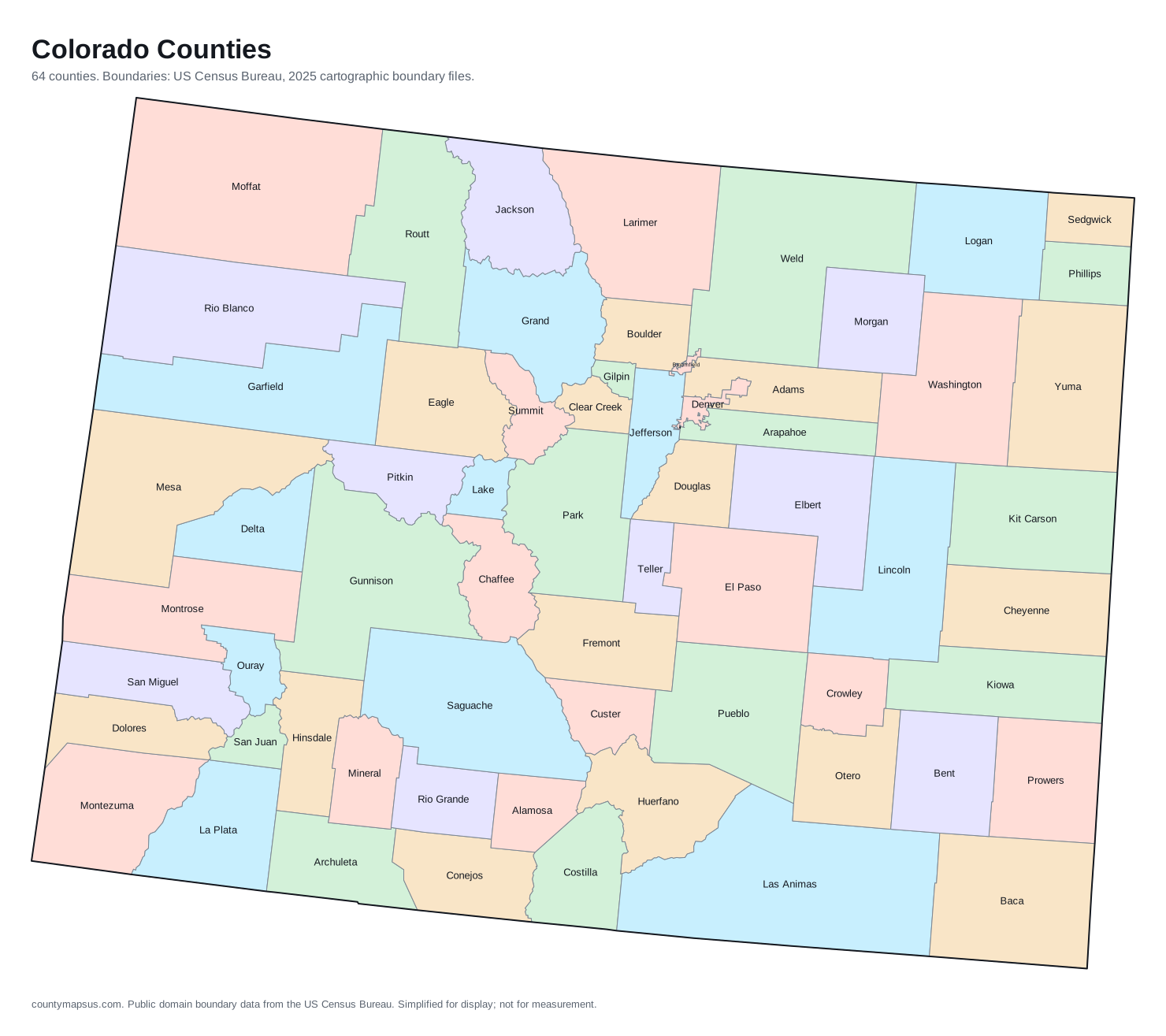
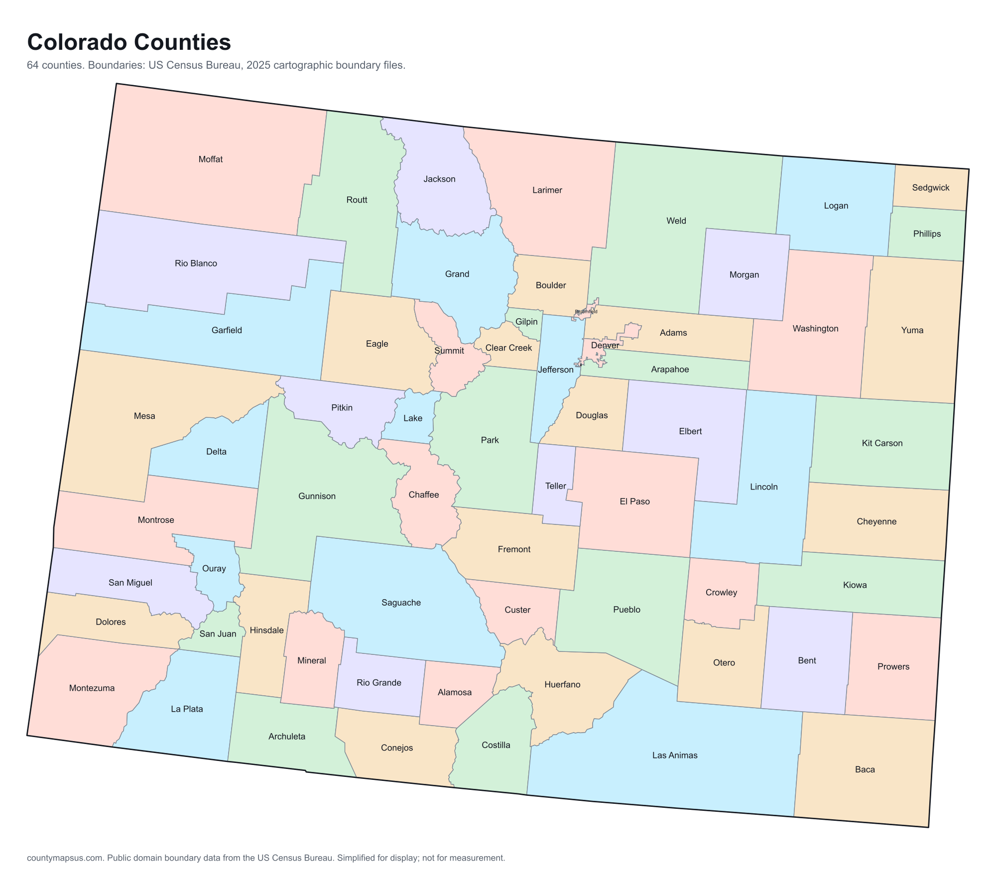
Colorado has 64 counties. Together they cover 103,637 sq mi of land and 6,012,561 people.
- Population
- Land area
- Density
Neighbouring areas are given different colours so their shared borders read clearly. These colours carry no data.
Population from the Vintage 2025 estimates. Breaks are quintiles within Colorado.
People per square mile, computed from population and land area. Breaks are quintiles within Colorado.
Median household income, American Community Survey 2020 to 2024 five-year estimates. Breaks are quintiles within Colorado.
- Counties
- 64
- 24th most of the 51 states and DC
- Population
- 6,012,561
- 20th largest
- Land area
- 103,637
- square miles
- Density
- 58.0
- people per square mile, computed
Sources: US Census Bureau, Population Estimates Program, Vintage 2025 Population Estimates, released 26 March 2026; US Census Bureau, Gazetteer Files, 2025 Gazetteer Files, released 10 September 2025. Retrieved 30 August 2026.
Download this map
Free to use and redistribute. The boundaries are public-domain Census Bureau data; attribution to County Maps US is appreciated but not required.
Satellite view
Aerial imagery of Colorado with the state boundary drawn on top. County lines are not drawn here: at this scale they would bury the picture, and the map above already carries them.
The extremes of Colorado
Which is the largest county in Colorado? The answer depends on whether you mean area or population.
The counties, by shape
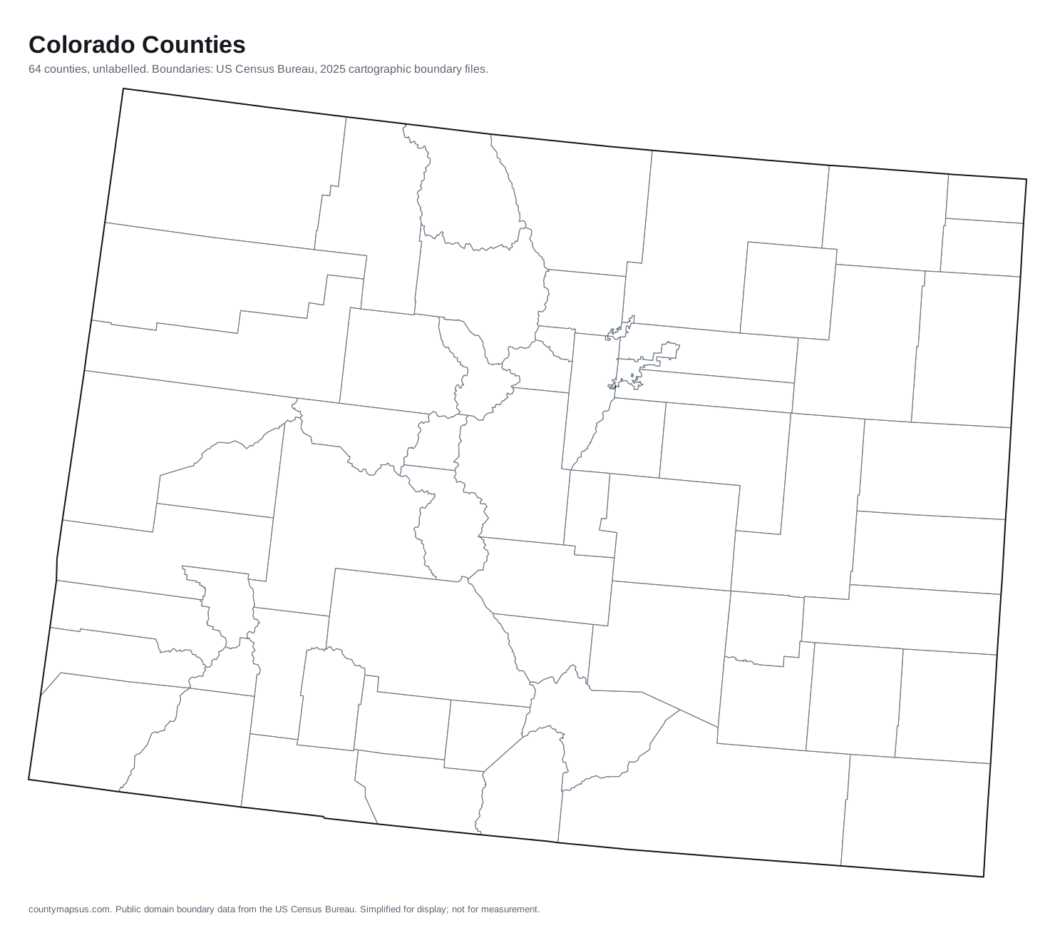
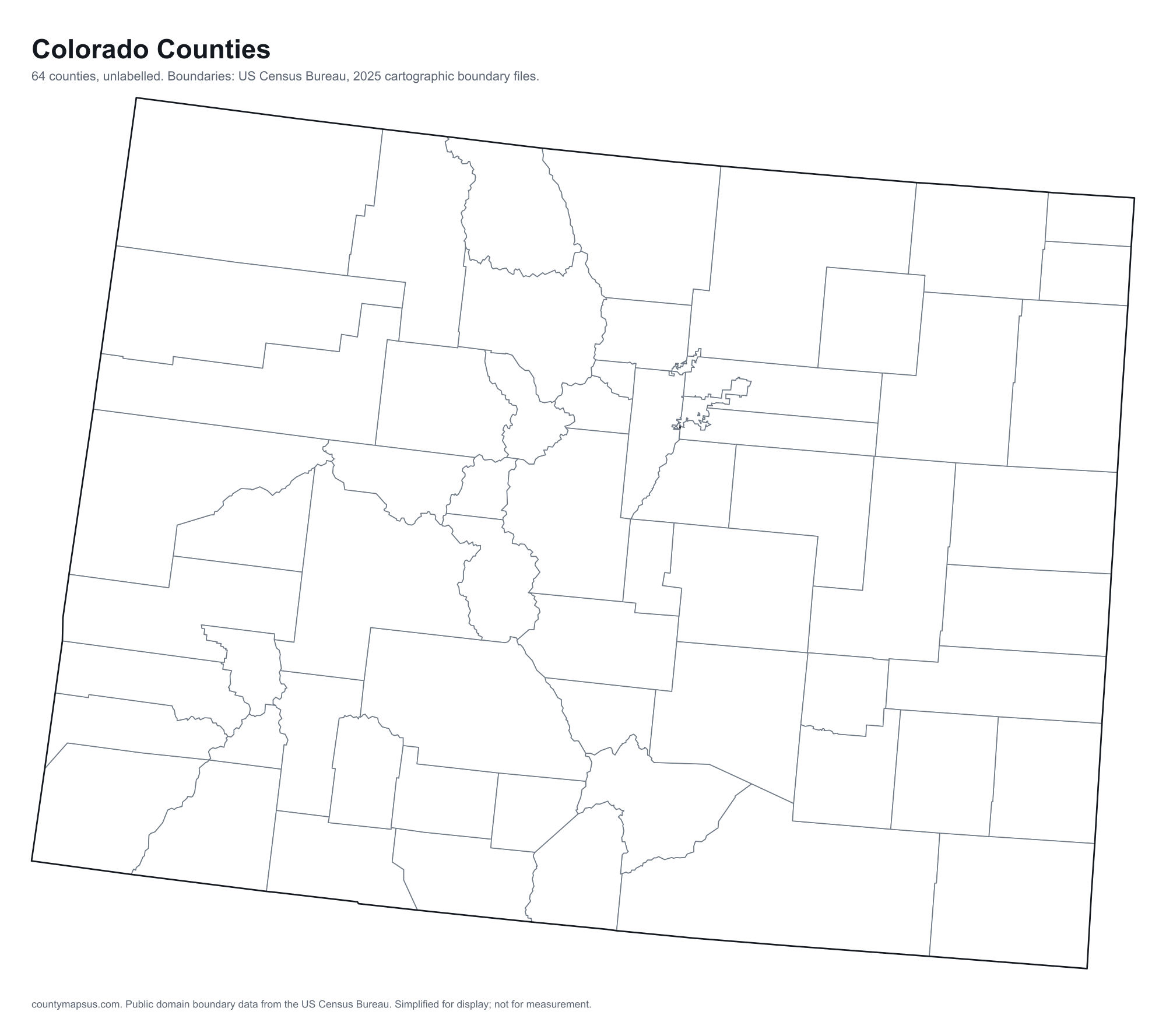
Every one, drawn to its own scale so the small ones stay recognisable. Shape alone is not a size comparison; the table below carries the areas.
- Adams
- Alamosa
- Arapahoe
- Archuleta
- Baca
- Bent
- Boulder
- Broomfield
- Chaffee
- Cheyenne
- Clear Creek
- Conejos
- Costilla
- Crowley
- Custer
- Delta
- Denver
- Dolores
- Douglas
- Eagle
- El Paso
- Elbert
- Fremont
- Garfield
- Gilpin
- Grand
- Gunnison
- Hinsdale
- Huerfano
- Jackson
- Jefferson
- Kiowa
- Kit Carson
- La Plata
- Lake
- Larimer
- Las Animas
- Lincoln
- Logan
- Mesa
- Mineral
- Moffat
- Montezuma
- Montrose
- Morgan
- Otero
- Ouray
- Park
- Phillips
- Pitkin
- Prowers
- Pueblo
- Rio Blanco
- Rio Grande
- Routt
- Saguache
- San Juan
- San Miguel
- Sedgwick
- Summit
- Teller
- Washington
- Weld
- Yuma
What the map does not say
The counties of Colorado are nowhere near the same size. Las Animas County covers 4,773 sq mi of land, 144.8 times the 33.0 sq mi of Broomfield County. People are spread even less evenly: Denver County packs 4,838 per sq mi while Hinsdale County holds 0.67 per sq mi.
They were not drawn in one sitting either. Weld County dates to 1861, and the boundaries were still being redrawn when Broomfield County was organised in 2001, 140 years later. Founding years come from Wikidata and are worth checking against the county's own history before citing.
And 27 of the 64 counties here share their names with counties in other states, so searching by name alone can land in the wrong place; the A to Z index lists every duplicate.
All 64 counties of Colorado
Sortable on any column. This table doubles as the text alternative to the map above: every area is a link, in alphabetical order, whether or not the map renders.
| Name | Population | Land area | Density | Median income | Seat | FIPS |
|---|---|---|---|---|---|---|
| Adams County | 554,668 | 1,167 sq mi | 475 per sq mi | $94,571 | Brighton | 08001 |
| Alamosa County | 16,688 | 722.6 sq mi | 23.1 per sq mi | $55,397 | Alamosa | 08003 |
| Arapahoe County | 673,820 | 797.9 sq mi | 845 per sq mi | $101,087 | Littleton | 08005 |
| Archuleta County | 14,306 | 1,350 sq mi | 10.6 per sq mi | $83,065 | Pagosa Springs | 08007 |
| Baca County | 3,347 | 2,555 sq mi | 1.3 per sq mi | $46,215 | Springfield | 08009 |
| Bent County | 5,716 | 1,513 sq mi | 3.8 per sq mi | $50,179 | Las Animas | 08011 |
| Boulder County | 328,560 | 726.4 sq mi | 452 per sq mi | $103,994 | Boulder | 08013 |
| Broomfield County | 79,174 | 33.0 sq mi | 2,402 per sq mi | $123,874 | Broomfield | 08014 |
| Chaffee County | 20,831 | 1,013 sq mi | 20.6 per sq mi | $84,132 | Salida | 08015 |
| Cheyenne County | 1,713 | 1,778 sq mi | 0.96 per sq mi | $70,865 | Cheyenne Wells | 08017 |
| Clear Creek County | 8,994 | 395.1 sq mi | 22.8 per sq mi | $94,577 | Georgetown | 08019 |
| Conejos County | 7,529 | 1,287 sq mi | 5.9 per sq mi | $50,978 | Conejos | 08021 |
| Costilla County | 3,679 | 1,228 sq mi | 3.0 per sq mi | $36,861 | San Luis | 08023 |
| Crowley County | 5,677 | 787.4 sq mi | 7.2 per sq mi | $48,826 | Ordway | 08025 |
| Custer County | 5,590 | 738.6 sq mi | 7.6 per sq mi | $72,674 | Westcliffe | 08027 |
| Delta County | 32,178 | 1,142 sq mi | 28.2 per sq mi | $57,774 | Delta | 08029 |
| Denver County | 740,613 | 153.1 sq mi | 4,838 per sq mi | $94,718 | Denver | 08031 |
| Dolores County | 2,466 | 1,067 sq mi | 2.3 per sq mi | $64,907 | Dove Creek | 08033 |
| Douglas County | 399,396 | 840.9 sq mi | 475 per sq mi | $149,594 | Castle Rock | 08035 |
| Eagle County | 54,291 | 1,684 sq mi | 32.2 per sq mi | $104,096 | Eagle | 08037 |
| El Paso County | 757,040 | 2,126 sq mi | 356 per sq mi | $90,363 | Colorado Springs | 08041 |
| Elbert County | 30,534 | 1,850 sq mi | 16.5 per sq mi | $132,685 | Kiowa | 08039 |
| Fremont County | 50,039 | 1,534 sq mi | 32.6 per sq mi | $62,664 | Cañon City | 08043 |
| Garfield County | 63,474 | 2,947 sq mi | 21.5 per sq mi | $91,131 | Glenwood Springs | 08045 |
| Gilpin County | 6,073 | 150 sq mi | 40.5 per sq mi | $95,361 | Central City | 08047 |
| Grand County | 16,496 | 1,847 sq mi | 8.9 per sq mi | $88,612 | Hot Sulphur Springs | 08049 |
| Gunnison County | 17,439 | 3,239 sq mi | 5.4 per sq mi | $84,527 | Gunnison | 08051 |
| Hinsdale County | 753 | 1,117 sq mi | 0.67 per sq mi | $75,972 | Lake City | 08053 |
| Huerfano County | 7,011 | 1,591 sq mi | 4.4 per sq mi | $52,526 | Walsenburg | 08055 |
| Jackson County | 1,211 | 1,614 sq mi | 0.75 per sq mi | $47,667 | Walden | 08057 |
| Jefferson County | 580,451 | 764.4 sq mi | 759 per sq mi | $110,656 | Golden | 08059 |
| Kiowa County | 1,412 | 1,768 sq mi | 0.80 per sq mi | $58,618 | Eads | 08061 |
| Kit Carson County | 7,069 | 2,161 sq mi | 3.3 per sq mi | $70,259 | Burlington | 08063 |
| La Plata County | 56,898 | 1,690 sq mi | 33.7 per sq mi | $86,056 | Durango | 08067 |
| Lake County | 7,552 | 376.9 sq mi | 20.0 per sq mi | $96,575 | Leadville | 08065 |
| Larimer County | 377,292 | 2,596 sq mi | 145 per sq mi | $93,765 | Fort Collins | 08069 |
| Las Animas County | 14,391 | 4,773 sq mi | 3.0 per sq mi | $52,074 | Trinidad | 08071 |
| Lincoln County | 5,645 | 2,578 sq mi | 2.2 per sq mi | $62,861 | Hugo | 08073 |
| Logan County | 20,654 | 1,839 sq mi | 11.2 per sq mi | $51,829 | Sterling | 08075 |
| Mesa County | 162,845 | 3,329 sq mi | 48.9 per sq mi | $73,658 | Grand Junction | 08077 |
| Mineral County | 910 | 875.8 sq mi | 1.0 per sq mi | $56,250 | Creede | 08079 |
| Moffat County | 13,122 | 4,743 sq mi | 2.8 per sq mi | $73,849 | Craig | 08081 |
| Montezuma County | 26,678 | 2,029 sq mi | 13.1 per sq mi | $65,244 | Cortez | 08083 |
| Montrose County | 44,591 | 2,241 sq mi | 19.9 per sq mi | $72,120 | Montrose | 08085 |
| Morgan County | 30,306 | 1,280 sq mi | 23.7 per sq mi | $73,278 | Fort Morgan | 08087 |
| Otero County | 17,683 | 1,262 sq mi | 14.0 per sq mi | $54,037 | La Junta | 08089 |
| Ouray County | 5,265 | 540.7 sq mi | 9.7 per sq mi | $91,020 | Ouray | 08091 |
| Park County | 18,314 | 2,194 sq mi | 8.4 per sq mi | $103,670 | Fairplay | 08093 |
| Phillips County | 4,420 | 687.9 sq mi | 6.4 per sq mi | $64,674 | Holyoke | 08095 |
| Pitkin County | 16,625 | 970.7 sq mi | 17.1 per sq mi | $102,645 | Aspen | 08097 |
| Prowers County | 11,884 | 1,638 sq mi | 7.3 per sq mi | $53,508 | Lamar | 08099 |
| Pueblo County | 169,277 | 2,387 sq mi | 70.9 per sq mi | $64,010 | Pueblo | 08101 |
| Rio Blanco County | 6,683 | 3,221 sq mi | 2.1 per sq mi | $65,473 | Meeker | 08103 |
| Rio Grande County | 11,087 | 912 sq mi | 12.2 per sq mi | $64,411 | Del Norte | 08105 |
| Routt County | 25,329 | 2,362 sq mi | 10.7 per sq mi | $106,489 | Steamboat Springs | 08107 |
| Saguache County | 6,732 | 3,169 sq mi | 2.1 per sq mi | $50,082 | Saguache | 08109 |
| San Juan County | 813 | 387.5 sq mi | 2.1 per sq mi | $77,824 | Silverton | 08111 |
| San Miguel County | 7,753 | 1,287 sq mi | 6.0 per sq mi | $79,024 | Telluride | 08113 |
| Sedgwick County | 2,247 | 548 sq mi | 4.1 per sq mi | $52,386 | Julesburg | 08115 |
| Summit County | 31,517 | 608.3 sq mi | 51.8 per sq mi | $109,773 | Breckenridge | 08117 |
| Teller County | 24,756 | 557.1 sq mi | 44.4 per sq mi | $85,361 | Cripple Creek | 08119 |
| Washington County | 4,732 | 2,518 sq mi | 1.9 per sq mi | $67,167 | Akron | 08121 |
| Weld County | 378,426 | 3,985 sq mi | 95.0 per sq mi | $97,097 | Greeley | 08123 |
| Yuma County | 9,896 | 2,364 sq mi | 4.2 per sq mi | $60,545 | Wray | 08125 |
Sources: US Census Bureau, Population Estimates Program, Vintage 2025 Population Estimates, released 26 March 2026; US Census Bureau, Gazetteer Files, 2025 Gazetteer Files, released 10 September 2025; US Census Bureau, American Community Survey, American Community Survey 2020-2024 5-Year Estimates, released 29 January 2026; Wikidata (CC0), Wikidata. Retrieved 30 August 2026.
Looking for Colorado County?
Colorado is also the name of 1 county in other states. If you meant one of those rather than the state of Colorado, they are listed here.
The ten most populous
- El Paso County757,040
- Denver County740,613
- Arapahoe County673,820
- Jefferson County580,451
- Adams County554,668
- Douglas County399,396
- Weld County378,426
- Larimer County377,292
- Boulder County328,560
- Pueblo County169,277
Data on this page last rebuilt 30 August 2026. How these figures are produced.