Indiana County Map
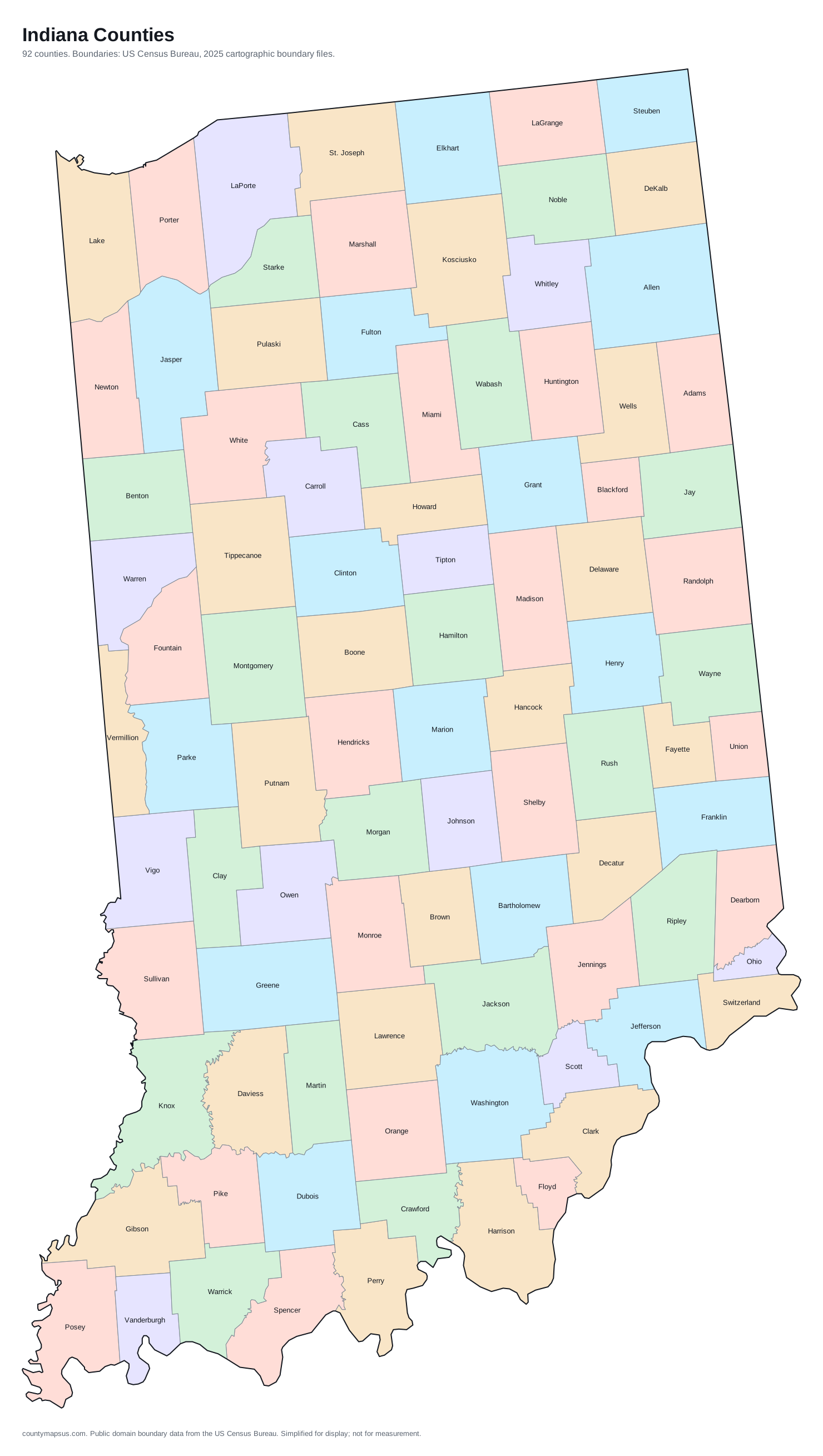
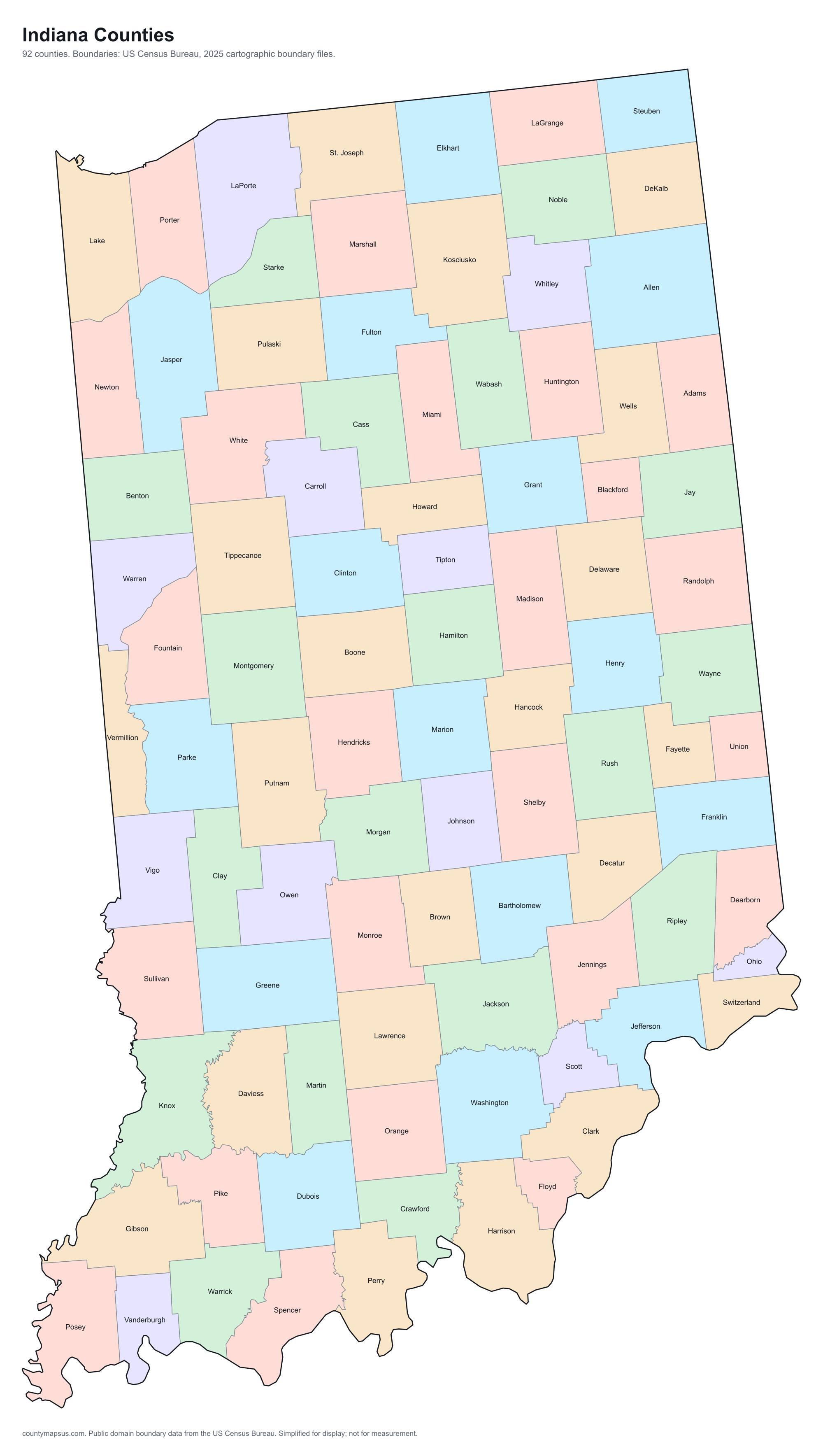
Indiana has 92 counties. Together they cover 35,825 sq mi of land and 6,973,333 people.
- Population
- Land area
- Density
Neighbouring areas are given different colours so their shared borders read clearly. These colours carry no data.
Population from the Vintage 2025 estimates. Breaks are quintiles within Indiana.
People per square mile, computed from population and land area. Breaks are quintiles within Indiana.
Median household income, American Community Survey 2020 to 2024 five-year estimates. Breaks are quintiles within Indiana.
- Counties
- 92
- 12th most of the 51 states and DC
- Population
- 6,973,333
- 17th largest
- Land area
- 35,825
- square miles
- Density
- 194.6
- people per square mile, computed
Sources: US Census Bureau, Population Estimates Program, Vintage 2025 Population Estimates, released 26 March 2026; US Census Bureau, Gazetteer Files, 2025 Gazetteer Files, released 10 September 2025. Retrieved 30 August 2026.
Download this map
Free to use and redistribute. The boundaries are public-domain Census Bureau data; attribution to County Maps US is appreciated but not required.
Satellite view
Aerial imagery of Indiana with the state boundary drawn on top. County lines are not drawn here: at this scale they would bury the picture, and the map above already carries them.
The extremes of Indiana
Which is the largest county in Indiana? The answer depends on whether you mean area or population.
The counties, by shape
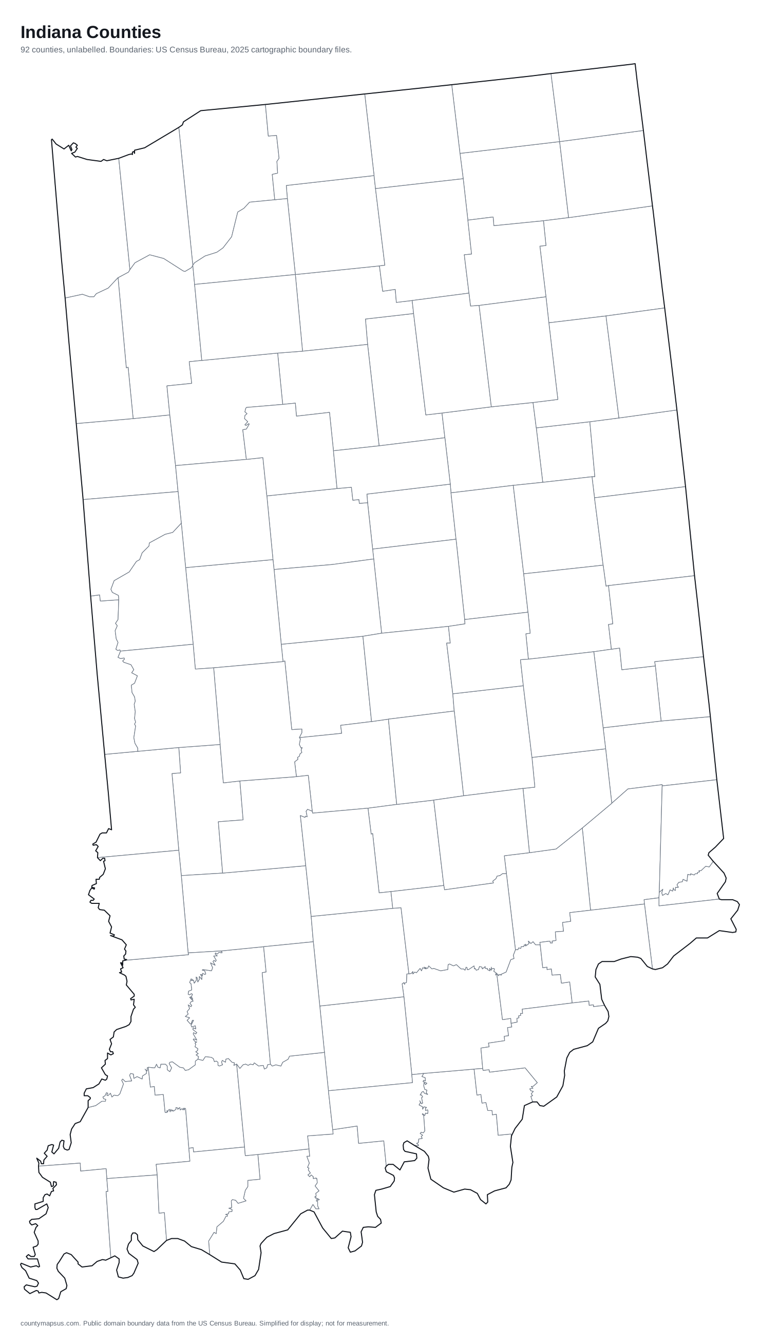
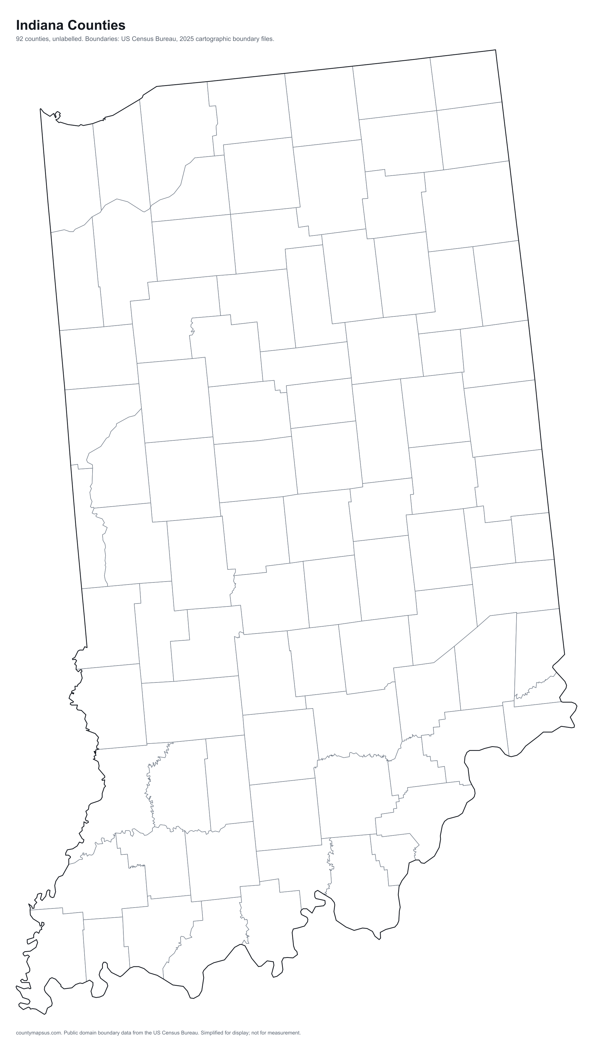
Every one, drawn to its own scale so the small ones stay recognisable. Shape alone is not a size comparison; the table below carries the areas.
- Adams
- Allen
- Bartholomew
- Benton
- Blackford
- Boone
- Brown
- Carroll
- Cass
- Clark
- Clay
- Clinton
- Crawford
- Daviess
- Dearborn
- Decatur
- DeKalb
- Delaware
- Dubois
- Elkhart
- Fayette
- Floyd
- Fountain
- Franklin
- Fulton
- Gibson
- Grant
- Greene
- Hamilton
- Hancock
- Harrison
- Hendricks
- Henry
- Howard
- Huntington
- Jackson
- Jasper
- Jay
- Jefferson
- Jennings
- Johnson
- Knox
- Kosciusko
- LaGrange
- Lake
- LaPorte
- Lawrence
- Madison
- Marion
- Marshall
- Martin
- Miami
- Monroe
- Montgomery
- Morgan
- Newton
- Noble
- Ohio
- Orange
- Owen
- Parke
- Perry
- Pike
- Porter
- Posey
- Pulaski
- Putnam
- Randolph
- Ripley
- Rush
- Scott
- Shelby
- Spencer
- St. Joseph
- Starke
- Steuben
- Sullivan
- Switzerland
- Tippecanoe
- Tipton
- Union
- Vanderburgh
- Vermillion
- Vigo
- Wabash
- Warren
- Warrick
- Washington
- Wayne
- Wells
- White
- Whitley
What the map does not say
The counties of Indiana are nowhere near the same size. Allen County covers 657.1 sq mi of land, 7.6 times the 86.2 sq mi of Ohio County. People are spread even less evenly: Marion County packs 2,506 per sq mi while Benton County holds 21.9 per sq mi.
They were not drawn in one sitting either. Knox County dates to 1790, and the boundaries were still being redrawn when Starke County was organised in 1850, 60 years later. Founding years come from Wikidata and are worth checking against the county's own history before citing.
Water is part of the picture too: 20.4% of Lake County is water, the most in the state, which is why its land area and total area disagree. And 69 of the 92 counties here share their names with counties in other states, so searching by name alone can land in the wrong place; the A to Z index lists every duplicate.
All 92 counties of Indiana
Sortable on any column. This table doubles as the text alternative to the map above: every area is a link, in alphabetical order, whether or not the map renders.
| Name | Population | Land area | Density | Median income | Seat | FIPS |
|---|---|---|---|---|---|---|
| Adams County | 36,650 | 338.9 sq mi | 108 per sq mi | $65,289 | Decatur | 18001 |
| Allen County | 402,329 | 657.1 sq mi | 612 per sq mi | $70,737 | Fort Wayne | 18003 |
| Bartholomew County | 85,729 | 406.9 sq mi | 211 per sq mi | $79,901 | Columbus | 18005 |
| Benton County | 8,883 | 406.4 sq mi | 21.9 per sq mi | $65,875 | Fowler | 18007 |
| Blackford County | 11,730 | 165.1 sq mi | 71.1 per sq mi | $51,326 | Hartford City | 18009 |
| Boone County | 80,689 | 422.9 sq mi | 191 per sq mi | $111,250 | Lebanon | 18011 |
| Brown County | 15,777 | 312 sq mi | 50.6 per sq mi | $78,528 | Nashville | 18013 |
| Carroll County | 20,655 | 372.2 sq mi | 55.5 per sq mi | $65,645 | Delphi | 18015 |
| Cass County | 37,836 | 412.1 sq mi | 91.8 per sq mi | $56,403 | Logansport | 18017 |
| Clark County | 130,451 | 372.5 sq mi | 350 per sq mi | $74,214 | Jeffersonville | 18019 |
| Clay County | 26,410 | 357.6 sq mi | 73.9 per sq mi | $70,010 | Brazil | 18021 |
| Clinton County | 33,322 | 405.1 sq mi | 82.3 per sq mi | $65,019 | Frankfort | 18023 |
| Crawford County | 10,509 | 305.6 sq mi | 34.4 per sq mi | $49,640 | English | 18025 |
| Daviess County | 34,209 | 429.5 sq mi | 79.6 per sq mi | $68,503 | Washington | 18027 |
| Dearborn County | 51,609 | 305.1 sq mi | 169 per sq mi | $84,735 | Lawrenceburg | 18029 |
| Decatur County | 26,576 | 372.6 sq mi | 71.3 per sq mi | $69,783 | Greensburg | 18031 |
| DeKalb County | 44,535 | 362.8 sq mi | 123 per sq mi | $74,331 | Auburn | 18033 |
| Delaware County | 113,106 | 392.1 sq mi | 288 per sq mi | $58,127 | Muncie | 18035 |
| Dubois County | 44,016 | 427.3 sq mi | 103 per sq mi | $75,979 | Jasper | 18037 |
| Elkhart County | 208,774 | 463.2 sq mi | 451 per sq mi | $68,561 | Goshen | 18039 |
| Fayette County | 23,533 | 215 sq mi | 109 per sq mi | $59,321 | Connersville | 18041 |
| Floyd County | 82,153 | 148.5 sq mi | 553 per sq mi | $79,704 | New Albany | 18043 |
| Fountain County | 17,013 | 395.7 sq mi | 43.0 per sq mi | $62,542 | Covington | 18045 |
| Franklin County | 23,286 | 384.4 sq mi | 60.6 per sq mi | $78,074 | Brookville | 18047 |
| Fulton County | 20,091 | 368.4 sq mi | 54.5 per sq mi | $61,360 | Rochester | 18049 |
| Gibson County | 33,091 | 487.4 sq mi | 67.9 per sq mi | $67,573 | Princeton | 18051 |
| Grant County | 66,524 | 414.1 sq mi | 161 per sq mi | $53,522 | Marion | 18053 |
| Greene County | 31,165 | 542.5 sq mi | 57.5 per sq mi | $62,094 | Bloomfield | 18055 |
| Hamilton County | 387,036 | 394.4 sq mi | 981 per sq mi | $121,530 | Noblesville | 18057 |
| Hancock County | 90,969 | 306 sq mi | 297 per sq mi | $93,186 | Greenfield | 18059 |
| Harrison County | 40,437 | 484.1 sq mi | 83.5 per sq mi | $74,475 | Corydon | 18061 |
| Hendricks County | 193,510 | 406.9 sq mi | 476 per sq mi | $101,144 | Danville | 18063 |
| Henry County | 49,137 | 391.9 sq mi | 125 per sq mi | $63,150 | New Castle | 18065 |
| Howard County | 83,904 | 293.1 sq mi | 286 per sq mi | $64,027 | Kokomo | 18067 |
| Huntington County | 37,224 | 382.6 sq mi | 97.3 per sq mi | $66,301 | Huntington | 18069 |
| Jackson County | 47,370 | 510 sq mi | 92.9 per sq mi | $70,262 | Brownstown | 18071 |
| Jasper County | 33,894 | 559.7 sq mi | 60.6 per sq mi | $77,314 | Rensselaer | 18073 |
| Jay County | 20,118 | 383.9 sq mi | 52.4 per sq mi | $54,969 | Portland | 18075 |
| Jefferson County | 33,279 | 360.7 sq mi | 92.3 per sq mi | $64,577 | Madison | 18077 |
| Jennings County | 27,622 | 376.6 sq mi | 73.3 per sq mi | $69,322 | Vernon | 18079 |
| Johnson County | 174,262 | 320.4 sq mi | 544 per sq mi | $90,454 | Franklin | 18081 |
| Knox County | 35,652 | 515.8 sq mi | 69.1 per sq mi | $61,237 | Vincennes | 18083 |
| Kosciusko County | 80,892 | 531.4 sq mi | 152 per sq mi | $75,317 | Warsaw | 18085 |
| LaGrange County | 41,305 | 379.6 sq mi | 109 per sq mi | $84,487 | LaGrange | 18087 |
| Lake County | 504,612 | 498.9 sq mi | 1,011 per sq mi | $71,493 | Crown Point | 18089 |
| LaPorte County | 111,294 | 598.3 sq mi | 186 per sq mi | $71,055 | La Porte | 18091 |
| Lawrence County | 45,568 | 449.1 sq mi | 101 per sq mi | $66,468 | Bedford | 18093 |
| Madison County | 135,088 | 451.9 sq mi | 299 per sq mi | $63,037 | Anderson | 18095 |
| Marion County | 992,196 | 396 sq mi | 2,506 per sq mi | $66,346 | Indianapolis | 18097 |
| Marshall County | 46,599 | 443.6 sq mi | 105 per sq mi | $71,808 | Plymouth | 18099 |
| Martin County | 9,856 | 335.8 sq mi | 29.4 per sq mi | $68,594 | Shoals | 18101 |
| Miami County | 34,487 | 373.8 sq mi | 92.3 per sq mi | $61,139 | Peru | 18103 |
| Monroe County | 143,345 | 394.5 sq mi | 363 per sq mi | $65,868 | Bloomington | 18105 |
| Montgomery County | 38,954 | 504.6 sq mi | 77.2 per sq mi | $71,479 | Crawfordsville | 18107 |
| Morgan County | 74,967 | 403.8 sq mi | 186 per sq mi | $79,429 | Martinsville | 18109 |
| Newton County | 14,188 | 401.8 sq mi | 35.3 per sq mi | $75,481 | Kentland | 18111 |
| Noble County | 47,937 | 410.8 sq mi | 117 per sq mi | $71,723 | Albion | 18113 |
| Ohio County | 5,994 | 86.2 sq mi | 69.6 per sq mi | $70,392 | Rising Sun | 18115 |
| Orange County | 19,834 | 398.4 sq mi | 49.8 per sq mi | $65,873 | Paoli | 18117 |
| Owen County | 21,886 | 385.3 sq mi | 56.8 per sq mi | $62,464 | Spencer | 18119 |
| Parke County | 16,642 | 444.7 sq mi | 37.4 per sq mi | $68,485 | Rockville | 18121 |
| Perry County | 19,389 | 381.7 sq mi | 50.8 per sq mi | $61,151 | Tell City | 18123 |
| Pike County | 12,003 | 334.4 sq mi | 35.9 per sq mi | $71,334 | Petersburg | 18125 |
| Porter County | 176,049 | 418.1 sq mi | 421 per sq mi | $87,972 | Valparaiso | 18127 |
| Posey County | 24,988 | 409.4 sq mi | 61.0 per sq mi | $78,129 | Mount Vernon | 18129 |
| Pulaski County | 12,463 | 433.7 sq mi | 28.7 per sq mi | $62,792 | Winamac | 18131 |
| Putnam County | 37,876 | 480.5 sq mi | 78.8 per sq mi | $78,378 | Greencastle | 18133 |
| Randolph County | 24,438 | 452.4 sq mi | 54.0 per sq mi | $60,791 | Winchester | 18135 |
| Ripley County | 29,434 | 446.4 sq mi | 65.9 per sq mi | $70,573 | Versailles | 18137 |
| Rush County | 16,767 | 408.1 sq mi | 41.1 per sq mi | $66,473 | Rushville | 18139 |
| Scott County | 25,053 | 190.4 sq mi | 132 per sq mi | $56,352 | Scottsburg | 18143 |
| Shelby County | 45,882 | 411.1 sq mi | 112 per sq mi | $72,190 | Shelbyville | 18145 |
| Spencer County | 20,061 | 396.9 sq mi | 50.5 per sq mi | $74,506 | Rockport | 18147 |
| St. Joseph County | 272,861 | 457.8 sq mi | 596 per sq mi | $66,868 | South Bend | 18141 |
| Starke County | 23,425 | 309.1 sq mi | 75.8 per sq mi | $63,960 | Knox | 18149 |
| Steuben County | 34,799 | 308.8 sq mi | 113 per sq mi | $74,911 | Angola | 18151 |
| Sullivan County | 20,831 | 447.2 sq mi | 46.6 per sq mi | $56,204 | Sullivan | 18153 |
| Switzerland County | 10,037 | 220.7 sq mi | 45.5 per sq mi | $65,343 | Vevay | 18155 |
| Tippecanoe County | 190,456 | 498.9 sq mi | 382 per sq mi | $60,636 | Lafayette | 18157 |
| Tipton County | 15,319 | 260.5 sq mi | 58.8 per sq mi | $76,156 | Tipton | 18159 |
| Union County | 6,863 | 161.2 sq mi | 42.6 per sq mi | $76,424 | Liberty | 18161 |
| Vanderburgh County | 181,995 | 233.4 sq mi | 780 per sq mi | $61,648 | Evansville | 18163 |
| Vermillion County | 15,488 | 256.9 sq mi | 60.3 per sq mi | $60,200 | Newport | 18165 |
| Vigo County | 106,512 | 403.6 sq mi | 264 per sq mi | $52,976 | Terre Haute | 18167 |
| Wabash County | 30,713 | 412.5 sq mi | 74.4 per sq mi | $66,806 | Wabash | 18169 |
| Warren County | 8,474 | 364.7 sq mi | 23.2 per sq mi | $82,425 | Williamsport | 18171 |
| Warrick County | 66,803 | 384.6 sq mi | 174 per sq mi | $89,844 | Boonville | 18173 |
| Washington County | 28,383 | 513.7 sq mi | 55.3 per sq mi | $64,641 | Salem | 18175 |
| Wayne County | 66,169 | 401.8 sq mi | 165 per sq mi | $55,692 | Richmond | 18177 |
| Wells County | 28,883 | 368.1 sq mi | 78.5 per sq mi | $71,957 | Bluffton | 18179 |
| White County | 25,164 | 505.2 sq mi | 49.8 per sq mi | $67,303 | Monticello | 18181 |
| Whitley County | 35,046 | 335.6 sq mi | 104 per sq mi | $78,083 | Columbia City | 18183 |
Sources: US Census Bureau, Population Estimates Program, Vintage 2025 Population Estimates, released 26 March 2026; US Census Bureau, Gazetteer Files, 2025 Gazetteer Files, released 10 September 2025; US Census Bureau, American Community Survey, American Community Survey 2020-2024 5-Year Estimates, released 29 January 2026; Wikidata (CC0), Wikidata. Retrieved 30 August 2026.
Looking for Indiana County?
Indiana is also the name of 1 county in other states. If you meant one of those rather than the state of Indiana, they are listed here.
The ten most populous
- Marion County992,196
- Lake County504,612
- Allen County402,329
- Hamilton County387,036
- St. Joseph County272,861
- Elkhart County208,774
- Hendricks County193,510
- Tippecanoe County190,456
- Vanderburgh County181,995
- Porter County176,049
Data on this page last rebuilt 30 August 2026. How these figures are produced.