Kansas County Map
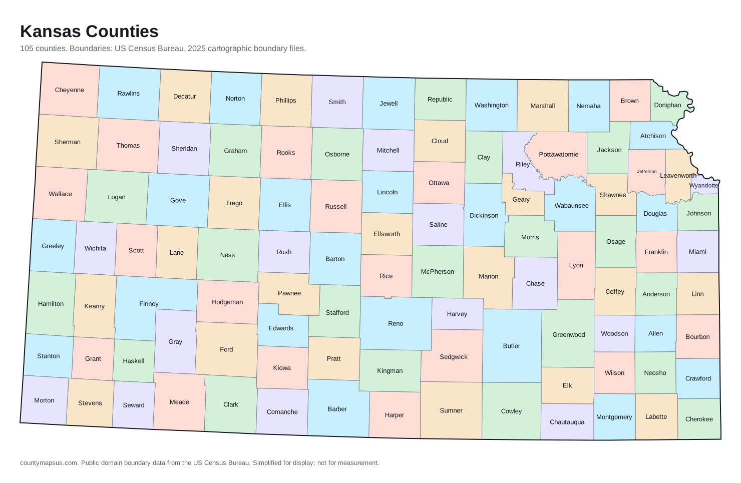
Kansas has 105 counties. Together they cover 81,759 sq mi of land and 2,977,220 people.
- Population
- Land area
- Density
Neighbouring areas are given different colours so their shared borders read clearly. These colours carry no data.
Population from the Vintage 2025 estimates. Breaks are quintiles within Kansas.
People per square mile, computed from population and land area. Breaks are quintiles within Kansas.
Median household income, American Community Survey 2020 to 2024 five-year estimates. Breaks are quintiles within Kansas.
- Counties
- 105
- 6th most of the 51 states and DC
- Population
- 2,977,220
- 34th largest
- Land area
- 81,759
- square miles
- Density
- 36.4
- people per square mile, computed
Sources: US Census Bureau, Population Estimates Program, Vintage 2025 Population Estimates, released 26 March 2026; US Census Bureau, Gazetteer Files, 2025 Gazetteer Files, released 10 September 2025. Retrieved 30 August 2026.
Download this map
Free to use and redistribute. The boundaries are public-domain Census Bureau data; attribution to County Maps US is appreciated but not required.
Satellite view
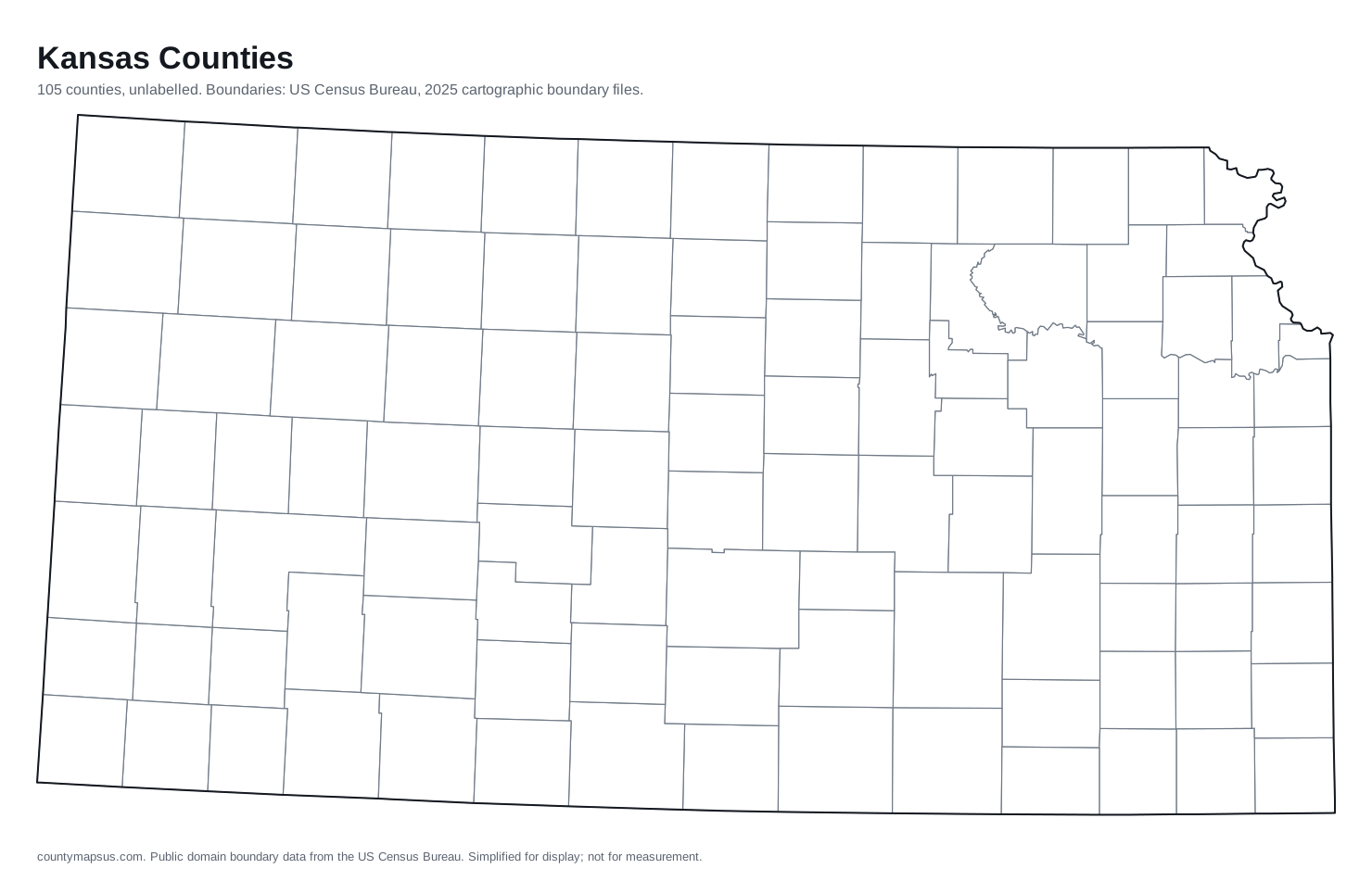
Aerial imagery of Kansas with the state boundary drawn on top. County lines are not drawn here: at this scale they would bury the picture, and the map above already carries them.
The extremes of Kansas
Which is the largest county in Kansas? The answer depends on whether you mean area or population.
The counties, by shape
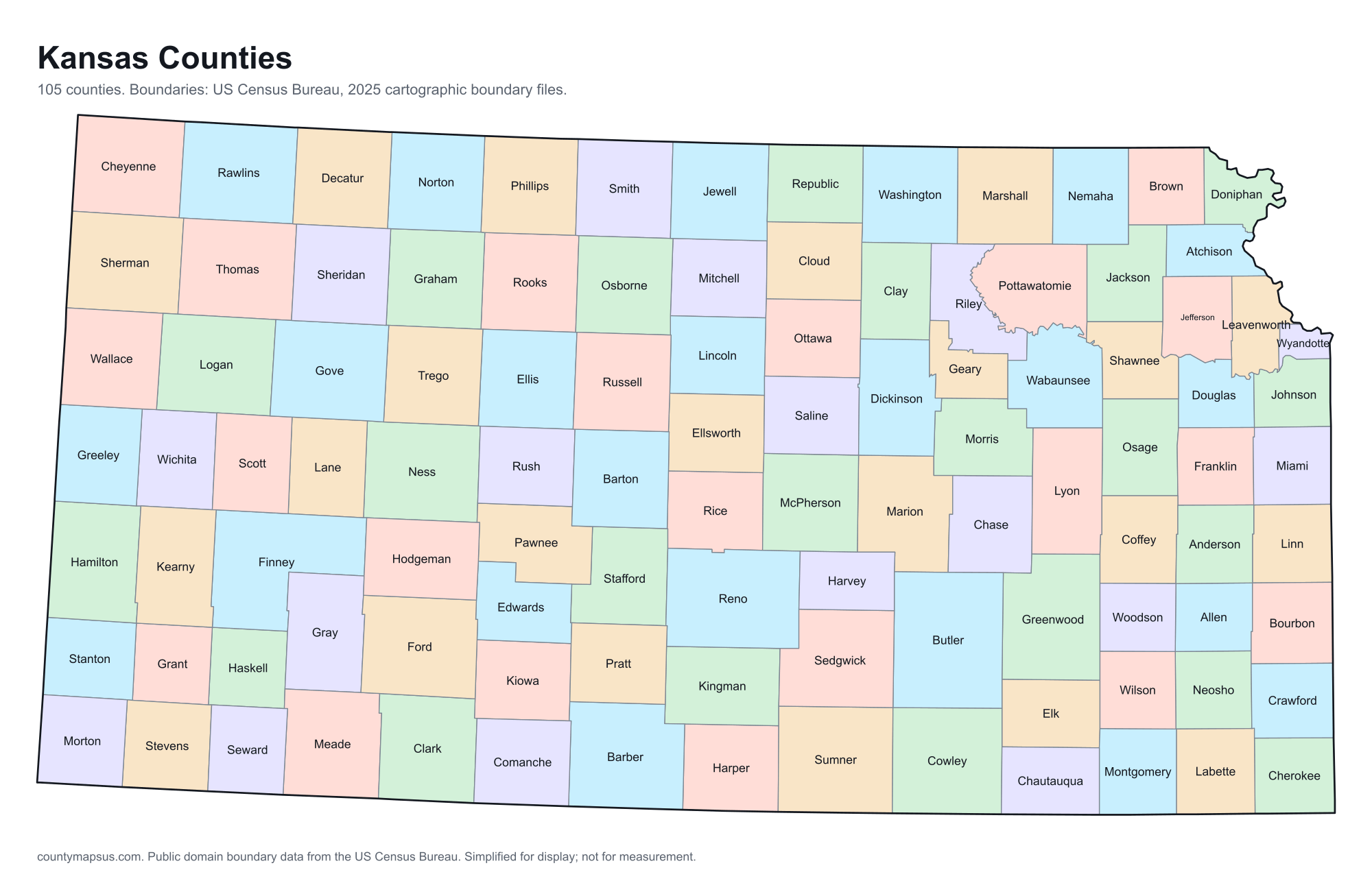
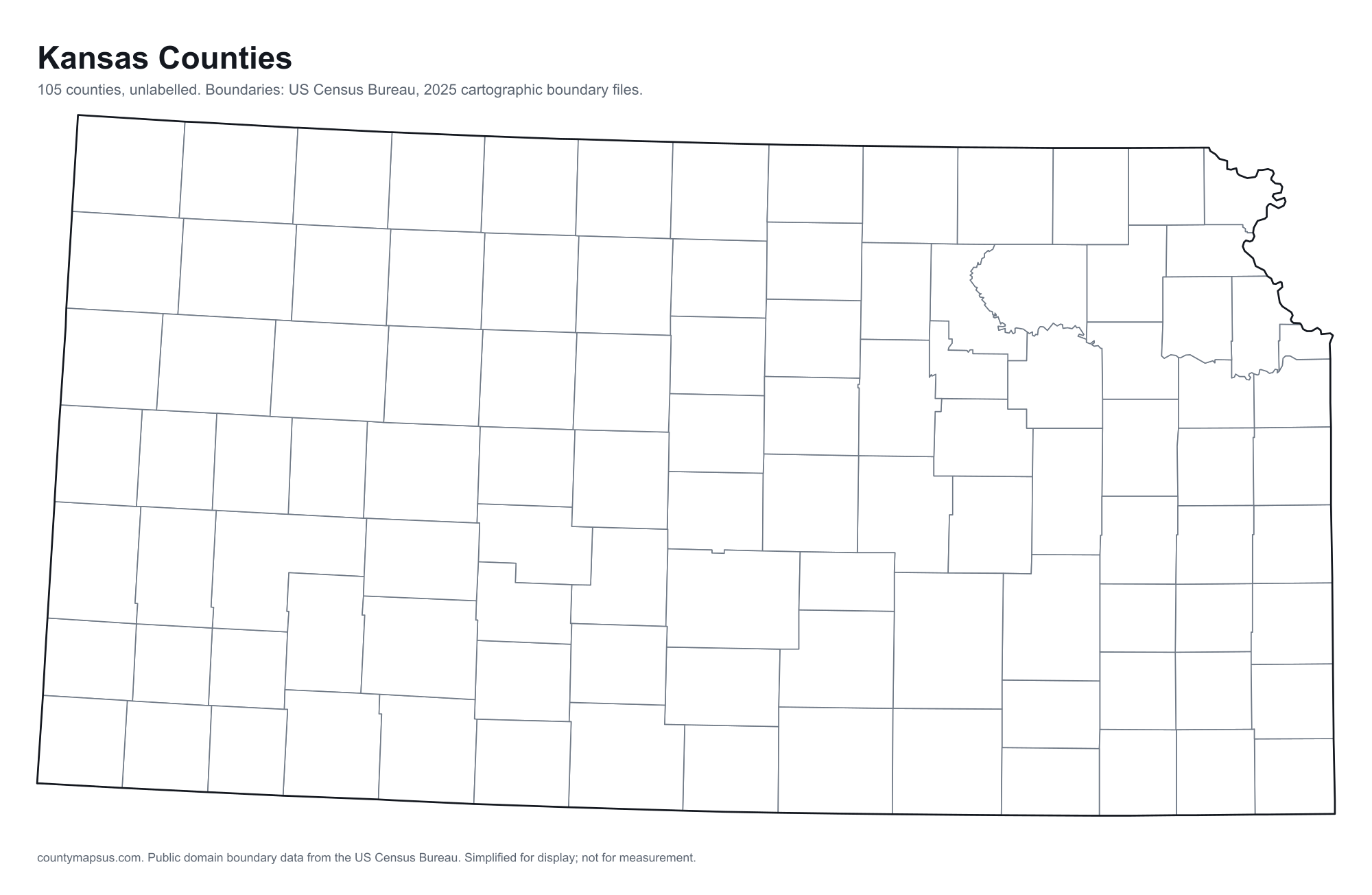
Every one, drawn to its own scale so the small ones stay recognisable. Shape alone is not a size comparison; the table below carries the areas.
- Allen
- Anderson
- Atchison
- Barber
- Barton
- Bourbon
- Brown
- Butler
- Chase
- Chautauqua
- Cherokee
- Cheyenne
- Clark
- Clay
- Cloud
- Coffey
- Comanche
- Cowley
- Crawford
- Decatur
- Dickinson
- Doniphan
- Douglas
- Edwards
- Elk
- Ellis
- Ellsworth
- Finney
- Ford
- Franklin
- Geary
- Gove
- Graham
- Grant
- Gray
- Greeley
- Greenwood
- Hamilton
- Harper
- Harvey
- Haskell
- Hodgeman
- Jackson
- Jefferson
- Jewell
- Johnson
- Kearny
- Kingman
- Kiowa
- Labette
- Lane
- Leavenworth
- Lincoln
- Linn
- Logan
- Lyon
- Marion
- Marshall
- McPherson
- Meade
- Miami
- Mitchell
- Montgomery
- Morris
- Morton
- Nemaha
- Neosho
- Ness
- Norton
- Osage
- Osborne
- Ottawa
- Pawnee
- Phillips
- Pottawatomie
- Pratt
- Rawlins
- Reno
- Republic
- Rice
- Riley
- Rooks
- Rush
- Russell
- Saline
- Scott
- Sedgwick
- Seward
- Shawnee
- Sheridan
- Sherman
- Smith
- Stafford
- Stanton
- Stevens
- Sumner
- Thomas
- Trego
- Wabaunsee
- Wallace
- Washington
- Wichita
- Wilson
- Woodson
- Wyandotte
What the map does not say
The counties of Kansas are nowhere near the same size. Butler County covers 1,430 sq mi of land, 9.4 times the 151.6 sq mi of Wyandotte County. People are spread even less evenly: Johnson County packs 1,345 per sq mi while Greeley County holds 1.5 per sq mi.
They were not drawn in one sitting either. Wyandotte County dates to 1855, and the boundaries were still being redrawn when Wallace County was organised in 1888, 33 years later. Founding years come from Wikidata and are worth checking against the county's own history before citing.
Water is part of the picture too: 4.9% of Geary County is water, the most in the state, which is why its land area and total area disagree. And 74 of the 105 counties here share their names with counties in other states, so searching by name alone can land in the wrong place; the A to Z index lists every duplicate.
All 105 counties of Kansas
Sortable on any column. This table doubles as the text alternative to the map above: every area is a link, in alphabetical order, whether or not the map renders.
| Name | Population | Land area | Density | Median income | Seat | FIPS |
|---|---|---|---|---|---|---|
| Allen County | 12,302 | 500.3 sq mi | 24.6 per sq mi | $60,689 | Iola | 20001 |
| Anderson County | 8,018 | 579.6 sq mi | 13.8 per sq mi | $70,614 | Garnett | 20003 |
| Atchison County | 16,172 | 431.2 sq mi | 37.5 per sq mi | $61,112 | Atchison | 20005 |
| Barber County | 4,083 | 1,134 sq mi | 3.6 per sq mi | $61,926 | Medicine Lodge | 20007 |
| Barton County | 24,790 | 895.3 sq mi | 27.7 per sq mi | $58,851 | Great Bend | 20009 |
| Bourbon County | 14,319 | 635.5 sq mi | 22.5 per sq mi | $59,238 | Fort Scott | 20011 |
| Brown County | 9,104 | 570.9 sq mi | 15.9 per sq mi | $62,233 | Hiawatha | 20013 |
| Butler County | 69,484 | 1,430 sq mi | 48.6 per sq mi | $81,610 | El Dorado | 20015 |
| Chase County | 2,572 | 773.1 sq mi | 3.3 per sq mi | $56,484 | Cottonwood Falls | 20017 |
| Chautauqua County | 3,321 | 638.9 sq mi | 5.2 per sq mi | $56,438 | Sedan | 20019 |
| Cherokee County | 19,105 | 587.6 sq mi | 32.5 per sq mi | $57,668 | Columbus | 20021 |
| Cheyenne County | 2,604 | 1,020 sq mi | 2.6 per sq mi | $55,429 | St. Francis | 20023 |
| Clark County | 1,900 | 974.6 sq mi | 2.0 per sq mi | $63,043 | Ashland | 20025 |
| Clay County | 7,990 | 645.3 sq mi | 12.4 per sq mi | $66,176 | Clay Center | 20027 |
| Cloud County | 8,833 | 715.3 sq mi | 12.3 per sq mi | $58,770 | Concordia | 20029 |
| Coffey County | 8,467 | 626.9 sq mi | 13.5 per sq mi | $70,346 | Burlington | 20031 |
| Comanche County | 1,673 | 788.3 sq mi | 2.1 per sq mi | $54,545 | Coldwater | 20033 |
| Cowley County | 34,382 | 1,126 sq mi | 30.5 per sq mi | $57,878 | Winfield | 20035 |
| Crawford County | 39,008 | 589.8 sq mi | 66.1 per sq mi | $52,844 | Girard | 20037 |
| Decatur County | 2,716 | 893.5 sq mi | 3.0 per sq mi | $53,870 | Oberlin | 20039 |
| Dickinson County | 18,637 | 847.1 sq mi | 22.0 per sq mi | $68,417 | Abilene | 20041 |
| Doniphan County | 7,594 | 393.5 sq mi | 19.3 per sq mi | $74,028 | Troy | 20043 |
| Douglas County | 120,920 | 455.8 sq mi | 265 per sq mi | $69,746 | Lawrence | 20045 |
| Edwards County | 2,640 | 621.9 sq mi | 4.3 per sq mi | $52,692 | Kinsley | 20047 |
| Elk County | 2,458 | 644.3 sq mi | 3.8 per sq mi | $64,609 | Howard | 20049 |
| Ellis County | 29,075 | 899.9 sq mi | 32.3 per sq mi | $63,084 | Hays | 20051 |
| Ellsworth County | 6,257 | 715.6 sq mi | 8.7 per sq mi | $65,560 | Ellsworth | 20053 |
| Finney County | 37,505 | 1,302 sq mi | 28.8 per sq mi | $73,009 | Garden City | 20055 |
| Ford County | 33,993 | 1,098 sq mi | 31.0 per sq mi | $70,781 | Dodge City | 20057 |
| Franklin County | 26,299 | 571.8 sq mi | 46.0 per sq mi | $77,207 | Ottawa | 20059 |
| Geary County | 36,338 | 384.7 sq mi | 94.5 per sq mi | $59,317 | Junction City | 20061 |
| Gove County | 2,631 | 1,072 sq mi | 2.5 per sq mi | $66,029 | Gove City | 20063 |
| Graham County | 2,371 | 898.5 sq mi | 2.6 per sq mi | $50,650 | Hill City | 20065 |
| Grant County | 7,028 | 574.8 sq mi | 12.2 per sq mi | $66,476 | Ulysses | 20067 |
| Gray County | 5,652 | 868.9 sq mi | 6.5 per sq mi | $79,122 | Cimarron | 20069 |
| Greeley County | 1,182 | 778.4 sq mi | 1.5 per sq mi | $80,565 | Tribune | 20071 |
| Greenwood County | 5,826 | 1,143 sq mi | 5.1 per sq mi | $60,042 | Eureka | 20073 |
| Hamilton County | 2,500 | 996.5 sq mi | 2.5 per sq mi | $70,250 | Syracuse | 20075 |
| Harper County | 5,370 | 801.3 sq mi | 6.7 per sq mi | $53,488 | Anthony | 20077 |
| Harvey County | 33,580 | 539.8 sq mi | 62.2 per sq mi | $74,368 | Newton | 20079 |
| Haskell County | 3,599 | 577.5 sq mi | 6.2 per sq mi | $66,162 | Sublette | 20081 |
| Hodgeman County | 1,619 | 860 sq mi | 1.9 per sq mi | $59,955 | Jetmore | 20083 |
| Jackson County | 13,438 | 656.2 sq mi | 20.5 per sq mi | $75,215 | Holton | 20085 |
| Jefferson County | 18,296 | 532.6 sq mi | 34.4 per sq mi | $81,278 | Oskaloosa | 20087 |
| Jewell County | 2,830 | 910 sq mi | 3.1 per sq mi | $52,634 | Mankato | 20089 |
| Johnson County | 636,906 | 473.6 sq mi | 1,345 per sq mi | $109,208 | Olathe | 20091 |
| Kearny County | 3,888 | 870.5 sq mi | 4.5 per sq mi | $89,135 | Lakin | 20093 |
| Kingman County | 7,029 | 863.4 sq mi | 8.1 per sq mi | $59,842 | Kingman | 20095 |
| Kiowa County | 2,432 | 722.6 sq mi | 3.4 per sq mi | $75,539 | Greensburg | 20097 |
| Labette County | 19,685 | 645.4 sq mi | 30.5 per sq mi | $56,325 | Oswego | 20099 |
| Lane County | 1,508 | 717.4 sq mi | 2.1 per sq mi | $54,526 | Dighton | 20101 |
| Leavenworth County | 84,590 | 463.4 sq mi | 183 per sq mi | $89,218 | Leavenworth | 20103 |
| Lincoln County | 2,861 | 719.4 sq mi | 4.0 per sq mi | $57,500 | Lincoln Center | 20105 |
| Linn County | 9,950 | 594.1 sq mi | 16.7 per sq mi | $59,069 | Mound City | 20107 |
| Logan County | 2,661 | 1,073 sq mi | 2.5 per sq mi | $75,662 | Oakley | 20109 |
| Lyon County | 32,266 | 847.5 sq mi | 38.1 per sq mi | $59,912 | Emporia | 20111 |
| Marion County | 11,634 | 944.3 sq mi | 12.3 per sq mi | $64,695 | Marion | 20115 |
| Marshall County | 9,852 | 900.2 sq mi | 10.9 per sq mi | $68,419 | Marysville | 20117 |
| McPherson County | 30,064 | 898.3 sq mi | 33.5 per sq mi | $78,851 | McPherson | 20113 |
| Meade County | 3,852 | 978.1 sq mi | 3.9 per sq mi | $71,852 | Meade | 20119 |
| Miami County | 36,240 | 575.9 sq mi | 62.9 per sq mi | $89,000 | Paola | 20121 |
| Mitchell County | 5,590 | 701.8 sq mi | 8.0 per sq mi | $64,246 | Beloit | 20123 |
| Montgomery County | 30,177 | 643.6 sq mi | 46.9 per sq mi | $55,697 | Independence | 20125 |
| Morris County | 5,348 | 695.3 sq mi | 7.7 per sq mi | $58,686 | Council Grove | 20127 |
| Morton County | 2,470 | 729.7 sq mi | 3.4 per sq mi | $66,447 | Elkhart | 20129 |
| Nemaha County | 10,054 | 717.4 sq mi | 14.0 per sq mi | $77,348 | Seneca | 20131 |
| Neosho County | 15,637 | 571.5 sq mi | 27.4 per sq mi | $56,618 | Erie | 20133 |
| Ness County | 2,617 | 1,075 sq mi | 2.4 per sq mi | $68,616 | Ness City | 20135 |
| Norton County | 5,288 | 878 sq mi | 6.0 per sq mi | $54,050 | Norton | 20137 |
| Osage County | 15,693 | 705.5 sq mi | 22.2 per sq mi | $74,467 | Lyndon | 20139 |
| Osborne County | 3,285 | 892.5 sq mi | 3.7 per sq mi | $63,011 | Osborne | 20141 |
| Ottawa County | 5,744 | 720.7 sq mi | 8.0 per sq mi | $74,018 | Minneapolis | 20143 |
| Pawnee County | 5,991 | 754.3 sq mi | 7.9 per sq mi | $63,517 | Larned | 20145 |
| Phillips County | 4,728 | 885.9 sq mi | 5.3 per sq mi | $62,123 | Phillipsburg | 20147 |
| Pottawatomie County | 27,186 | 840.7 sq mi | 32.3 per sq mi | $92,325 | Westmoreland | 20149 |
| Pratt County | 9,117 | 735 sq mi | 12.4 per sq mi | $66,022 | Pratt | 20151 |
| Rawlins County | 2,431 | 1,069 sq mi | 2.3 per sq mi | $67,742 | Atwood | 20153 |
| Reno County | 61,539 | 1,255 sq mi | 49.0 per sq mi | $60,645 | Hutchinson | 20155 |
| Republic County | 4,640 | 717.4 sq mi | 6.5 per sq mi | $56,833 | Belleville | 20157 |
| Rice County | 9,266 | 726.2 sq mi | 12.8 per sq mi | $63,925 | Lyons | 20159 |
| Riley County | 72,598 | 609.7 sq mi | 119 per sq mi | $61,098 | Manhattan | 20161 |
| Rooks County | 4,646 | 890.5 sq mi | 5.2 per sq mi | $62,500 | Stockton | 20163 |
| Rush County | 2,845 | 717.8 sq mi | 4.0 per sq mi | $59,970 | La Crosse | 20165 |
| Russell County | 6,581 | 886.3 sq mi | 7.4 per sq mi | $62,392 | Russell | 20167 |
| Saline County | 53,377 | 720.2 sq mi | 74.1 per sq mi | $65,422 | Salina | 20169 |
| Scott County | 4,815 | 717.6 sq mi | 6.7 per sq mi | $68,839 | Scott City | 20171 |
| Sedgwick County | 538,433 | 997 sq mi | 540 per sq mi | $69,365 | Wichita | 20173 |
| Seward County | 21,073 | 639.7 sq mi | 32.9 per sq mi | $63,827 | Liberal | 20175 |
| Shawnee County | 178,607 | 544 sq mi | 328 per sq mi | $67,104 | Topeka | 20177 |
| Sheridan County | 2,427 | 896 sq mi | 2.7 per sq mi | $73,750 | Hoxie | 20179 |
| Sherman County | 5,763 | 1,056 sq mi | 5.5 per sq mi | $61,750 | Goodland | 20181 |
| Smith County | 3,566 | 895.5 sq mi | 4.0 per sq mi | $59,135 | Smith Center | 20183 |
| Stafford County | 4,005 | 792 sq mi | 5.1 per sq mi | $64,226 | St. John | 20185 |
| Stanton County | 1,986 | 680.4 sq mi | 2.9 per sq mi | $71,700 | Johnson City | 20187 |
| Stevens County | 4,984 | 727.4 sq mi | 6.9 per sq mi | $64,178 | Hugoton | 20189 |
| Sumner County | 22,312 | 1,182 sq mi | 18.9 per sq mi | $63,951 | Wellington | 20191 |
| Thomas County | 7,725 | 1,075 sq mi | 7.2 per sq mi | $71,325 | Colby | 20193 |
| Trego County | 2,740 | 889.5 sq mi | 3.1 per sq mi | $81,528 | WaKeeney | 20195 |
| Wabaunsee County | 7,018 | 794.3 sq mi | 8.8 per sq mi | $76,908 | Alma | 20197 |
| Wallace County | 1,441 | 913.7 sq mi | 1.6 per sq mi | $63,207 | Sharon Springs | 20199 |
| Washington County | 5,533 | 894.8 sq mi | 6.2 per sq mi | $65,482 | Washington | 20201 |
| Wichita County | 2,031 | 718.6 sq mi | 2.8 per sq mi | $79,063 | Leoti | 20203 |
| Wilson County | 8,299 | 570.4 sq mi | 14.5 per sq mi | $60,677 | Fredonia | 20205 |
| Woodson County | 3,118 | 497.8 sq mi | 6.3 per sq mi | $50,326 | Yates Center | 20207 |
| Wyandotte County | 170,597 | 151.6 sq mi | 1,125 per sq mi | $63,631 | Kansas City | 20209 |
Sources: US Census Bureau, Population Estimates Program, Vintage 2025 Population Estimates, released 26 March 2026; US Census Bureau, Gazetteer Files, 2025 Gazetteer Files, released 10 September 2025; US Census Bureau, American Community Survey, American Community Survey 2020-2024 5-Year Estimates, released 29 January 2026; Wikidata (CC0), Wikidata. Retrieved 30 August 2026.
The ten most populous
- Johnson County636,906
- Sedgwick County538,433
- Shawnee County178,607
- Wyandotte County170,597
- Douglas County120,920
- Leavenworth County84,590
- Riley County72,598
- Butler County69,484
- Reno County61,539
- Saline County53,377
Data on this page last rebuilt 30 August 2026. How these figures are produced.